  • English
  • Español
  • Français

United
Nations


Office for Outer Space Affairs
UN-SPIDER Knowledge Portal

  • Accueil
  • À propos
    • Qu'est-ce que l'ONU-SPIDER?
    • À propos d’UNOOSA
    • Publications
    • Offres d'emploi
    • Rencontrez l'équipe
    • Contact
  • Applications spatiales
    • Technologie satellitaire
    • Mécanismes d’urgence
    • Recovery Mechanisms
    • Réseau international d'alerte aux astéroïdes
    • Space Mission Planning Advisory Group
    • Initiative internationale sur la météorologie spatiale
    • Les technologies spatiales à l'ONU
    • Comptes-rendus d'utilisateurs
  • Liens & ressources
    • Application de données du mois
      • Disaster Recovery
    • Sources de données
    • SIG et logiciels de télédétection
    • Online Learning Resources
    • Institutions
  • Risques & catastrophes
    • Prévention des risques de catastrophe
    • Systèmes d'alerte précoce
    • Gestion des catastrophes et des interventions d'urgence
    • Aléas naturels
    • Cadre d'action de Sendai
    • L'ONU et la prévention des risques de catastrophe
    • L'ONU et les alertes précoces
    • L'ONU et la gestion des catastrophes
  • Appui technique
    • Missions Conseil
    • Appui d’urgence
    • Appui à distance
    • Pratiques recommandées
    • Activités de formation
    • Utilisations pratiques
  • Réseaux
    • Bureaux régionaux d’appui
    • GP-STAR
    • MHEWS
    • IWG-SEM
  • Projets
    • SPEAR
    • SEWS-D
    • EvIDENz
    • Flood GUIDE
  • Actualités
    • Actualités
    • Événements
    • Événements passés

Breadcrumb

  • Home
  • TerraSAR-X: Five Years In Space
  • TerraSAR-X: Five years in space

TerraSAR-X: Five years in space

On 15 June 2007, the German TerraSAR-X radar satellite was launched from Russia's Baikonur Cosmodrome in Kazakhstan marking the beginning of a new era in German remote sensing. In its fifth year in space TerraSAR-X has served its planned life-span, but is expected to continue functioning for several years. "TerraSAR-X has now been operating almost flawlessly for five years. The satellite's propellant consumption has been low, the solar arrays and radar instrument are in good condition, and all of the redundant systems are still available. We could not have hoped for more," states Michael Bartusch, TerraSAR-X mission Project Manager at the German Aerospace Center (DLR).

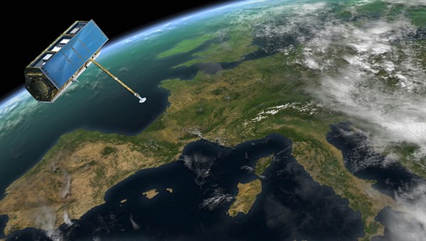
TerraSAR-X can survey Earth regardless of cloud coverage or weather conditions thanks to its on-board Synthetic Aperture Radar (SAR) system. It can provide imagery with resolutions of one meter allowing the provision of high quality data for science, disaster and risk management and commercial purposes - particularly concerning time-sequenced images. TerraSAR-X was constructed by Astrium on behalf of DLR and its data is distributed by the German division of Astrium Geo-Information Services, Infoterra GmbH.

DLR
Mon, 18 Jun 2012 - 10:36
Germany

Footer menu

  • Contact
  • Terms of Use

User account menu

  • Log in