![]()
United
Nations
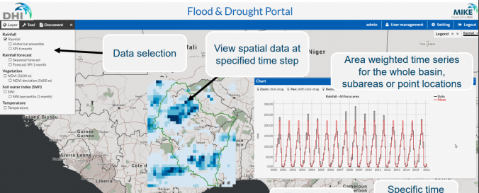
Flood & Drought Portal (UNEP)
| Data provided by: | United Nations Environment Programme (UNEP) |
| Data accessibility: | statistical data (e.g. graphs), visualization of data (e.g. web GIS or real time monitoring), web processing/cloud computing |
| Link to the data: | |
| Data type: | hazard specific data |
| Disaster cycle phase: | Disaster Risk Management, Response, Recovery |
| Space-based Information: | Satellite based flood maps |
| Spatial coverage: | Global |
| Temporal coverage: | Archive, Near-real time |
| Costs: | free |
| Contact: | DHI Contact |
| Tutorials on the use of data: | Search 6 0:07 / 1:26 Navigate the Flood and Drought Portal, Use the Knowledge Portal |
| Restrictions/ Citation of the dataset: |
Provider
![]()