![]()
United
Nations
Flood & Drought Portal (UNEP)
| Data provided by: | United Nations Environment Programme (UNEP) |
| Data accessibility: | Datos estadísticos (ej. gráficos), Visualización de datos (ej. web SIG o monitoreo en tiempo real), Procesamiento web/computación en la nube |
| Link to the data: | |
| Data type: | Datos sobre amenazas específicas |
| Disaster cycle phase: | Gestión des Riesgo por Desastres, Respuesta, Recuperación |
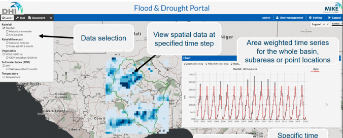
| Space-based Information: | Satellite based flood maps |
| Spatial coverage: | Global |
| Temporal coverage: | Archivado, Casi en tiempo real |
| Costs: | Gratis |
| Contact: | DHI Contact |
| Tutorials on the use of data: | Search 6 0:07 / 1:26 Navigate the Flood and Drought Portal, Use the Knowledge Portal |
| Restrictions/ Citation of the dataset: |
Provider
![]()