Tormenta severa
Definition
Facts and figures
Further information
UN-SPIDER Regional Support Offices with hazard-specific expertise
Related content on the Knowledge Portal
Southern Africa is exposed to hydrometeorological, geological, coastal and biological hazards. The region has been hard hit by droughts in recent years. Tropical cyclone Idai triggered massive floods in Mozambique, Malawi, and Zimbabwe in March 2019, and in 2020 several countries experience a severe locust outbreak. And unfortunately, COVID-19 continues to impact all countries in this region.
To continue efforts to promote the use of space technologies in disaster risk management, emergency response and recovery efforts, UN-SPIDER and the Centre for Remote Sensing of Land Surfaces of the University of Bonn (ZFL) joined forces to organize the UN-SPIDER / ZFL Regional Virtual Expert Meeting for Southern Africa "Space-based Solutions for Disaster Risk Management and Emergency Response" from 13 to 15 July 2021. This regional expert meeting contributed to the efforts conducted by UN-SPIDER on disaster risk reduction, preparedness, early...
read more19/07/2021- Publishing institution:
- Publishing institution:
- Publishing institution:
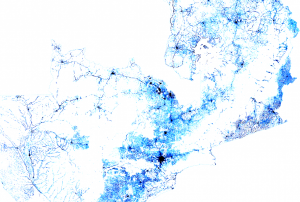
- Facebook Connectivity Lab in collaboration with the Center for International Earth Science Information Network (CIESIN) at Colombia University combines machine vision AI with satellite imagery and census information to create population density maps. With the integration of demographic information, specifically related to age and gender, these maps collectively provide information on both the location and the demographic of a population in a certain country. The population density maps cover the majority of countries around the world.Publishing institution:
- Facebook Connectivity Lab in collaboration with the Center for International Earth Science Information Network (CIESIN) at Colombia University combines machine vision AI with satellite imagery and census information to create population density maps. With the integration of demographic information, specifically related to age and gender, these maps collectively provide information on both the location and the demographic of a population in a certain country. The population density maps cover the majority of countries around the world.Publishing institution:
Having reliable and timely population distribution data can make a life or death difference for individuals facing crises or living in conflict-ridden regions. These data are also essential for development decision-making and planning and for monitoring progress towards the UN Sustainable Development Goals (SDGs) established by the international community. We need to know where people are located, what conditions they are facing, what infrastructure is available, and what basic services they can access. We also need to ensure that no one is left off the map in pursuit of meeting the SDGs.
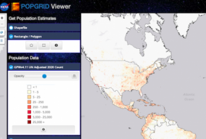
Gridded population data, which often use remote sensing inputs to improve the spatial allocation of population within a country, are vital for all these purposes. Together with the growing variety of applications that require spatial population data, there is now a bewildering array of population grids, and users need to know which ones are most suitable for their applications...
read moreThe United Nations Office for Outer Space Affairs (UNOOSA) and the National Aeronautics and Space Administration of the United States Government (NASA) signed a landmark Memorandum of Understanding (MoU) on 17 December 2020 pledging cooperation in areas of science and technology to support the peaceful uses of outer space.
The MoU brings together NASA's wealth of open-source spacecraft data, tools, and expertise and UNOOSA's unique position as the only UN entity dedicated to outer space affairs, to expand global opportunities to leverage the benefits of space. The partners will design capacity-building programmes, particularly for institutions in countries that do not yet have or that are developing space capabilities, to help them access space.
Together, UNOOSA and NASA will develop ways to leverage the Artemis programme as part of UNOOSA's Access to Space 4 All Initiative, which offers opportunities for international researchers and institutions, especially in...
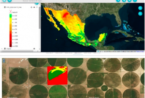
read more11/01/2021In collaboration with the National Commission for Space Activities (CONAE) of Argentina, the Mexican Space Agency (AEM) recently launched a digital platform to improve the integration of satellite data for environmental monitoring in Latin America. The Comprehensive Regional Satellite Information System (SIRIS) provides access to satellite information in order to enhance decision-making and facilitate disaster management.
The SIRIS platform provides access to satellite imagery for different areas. The platform supplies information on the agriculture and forestry sector to better monitor the impact of natural disasters on agricultural production and woodland. It also offers up-to-date and archived data on fires to strengthen early warning and build long-term resilience. On floods, information provided by SIRIS indicates the water level to improve damage evaluation of the impacted area and facilitate humanitarian relief. In...
read more20/12/2020


