Deslizamiento de tierra
Definition
Facts and figures
Further information
UN-SPIDER Regional Support Offices with hazard-specific expertise
Related content on the Knowledge Portal
A new report outlines the impact of Global Human Settlement Layer (GHSL) data on various policy areas. The 2020 edition of the “Atlas of the Human Planet”, recently published and launched virtually by the Joint Research Centre (JRC) of the European Commission as a deliverable to the Group on Earth Observations (GEO) Human Planet Initiative, explores the impact of GHSL data on various policy areas, including disaster risk management.
GHSL data refers to “global spatial information, evidence-based analytics and knowledge describing the human presence on the planet”. This data relies on spatial information from Landsat 8, Sentinel-1 and Sentinel-2. It is mainly cost-free and...
read more18/02/2021The use of multi-risk information systems is crucial in confronting the increasing risks posed by natural hazards. In some cases, risk is increasing due to inadequate land-use norms or regulations that allow for the construction of infrastructure in areas exposed to such natural hazards. In other cases, vulnerability increases due to lack of awareness or extreme poverty. The need to address risks from the point of view of multiple hazards is necessary to contribute to sustainable development and has been incorporated as an essential element of the Sendai Framework for Disaster Risk Reduction 2015-2030. For this purpose, the RIESGOS 2.0 project was launched in March 2021. Under the coordination of the German Aerospace Center (DLR), the project builds on the accomplishments of its predecessor - RIESGOS - as a multi-risk information system that models and simulates natural...
read more17/03/2021A new report by the world’s largest humanitarian aid network highlights global disasters, populations most vulnerable to them and the efforts of local institutions in preventing, preparing for and responding to them. The 2020 edition of the World Disasters Report, “Come Heat or High Water”, was launched virtually from the offices of the International Federation of Red Cross and Red Crescent Societies (IFRC) in Vienna on November 16. This year’s report discusses climate- and weather-related disasters and their humanitarian impact. It argues for the usefulness of smart financing and space-based information in disaster management support.
The report warns that the global effort to address climate change is leaving behind...
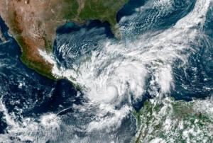
read more19/11/2020The hurricane season in Central America normally quiets down at the end of October, but this year is one of those rare years when tropical storms and hurricanes in the region have occured beyond the typical season. With 30 events thus far, the 2020 tropical storm season in the Caribbean continues to take its toll in developing countries in Central America. Hurricane Eta entered the west coast of Nicaragua on 3 November as a Category 4 hurricane – the second-highest classification category. It triggered massive floods in Nicaragua, Honduras and Guatemala. In some regions, the magnitude of these floods was similar to those triggered by Hurricane Mitch in 1998, which devastated the region and killed more than 35,000 people throughout Central America. Fortunately, the consequences of Hurricane Eta were much smaller.
UN-SPIDER has been supporting disaster response efforts to Hurricane Eta at the request of the...
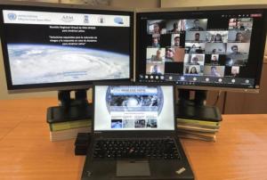
read more16/11/2020In order to discuss and promote the use of space technologies in addressing natural hazards such as forest fires and landslides in Latin America, UN-SPIDER conducted a virtual regional expert meeting on the topic of “Space-based Solutions for Disaster Risk Reduction and Emergency Response in Latin America” from 22 to 24 September 2020. The meeting was jointly organized with UN-SPIDER Regional Support Offices from Argentina (National Space Activities Commission, CONAE), Brazil (Federal University of Santa Maria, UFSM), Colombia (Geographic Institute Agustin Condazzi, IGAC), and Mexico (Mexican Space Agency, AEM).
In Latin America, UN-SPIDER and its Regional Support Offices have regularly carried out regional expert meetings, training courses and other joint efforts since 2011. The last Regional Expert Meeting took place in 2017 in Mexico.
The meeting, which consisted of three two-hour-long sessions, brought together a total of over 200 disaster management stakeholders...
read moreRegional Support Offices mentioned:28/09/2020- The Argentinean SAOCOM 1B satellite [was successfully launched](https://www.argentina.gob.ar/noticias/argentina-lanzo-el-satelite-saocom-1b-y-completo-la-mision-espacial-mas-importante-del-pais) into orbit on 30 August 2020. Developed by the National Argentinean Space Commission (CONAE), this new satellite will join SAOCOM 1A and four Italian COSMO-SkyMed to complete the joint Italian-Argentinean Satellite System for Emergency Management (SIASGE). Like its predecessor, SAOCOM 1B was built in Argentina through a joint effort with private companies and universities. It will operate at an elevation of 620 kilometers above the surface of the Earth. A SpaceX Falcon 9 booster launched the satellite from Space Launch Complex 40 at Cape Canaveral Air Force Station in Florida, United States of America. The SAOCOM 1B satellite has been fitted with a Synthetic Aperture Radar (SAR) sensor that makes use of microwaves in the electromagnetic L-band, which goes through clouds and works without... read moreRegional Support Offices mentioned:14/09/2020
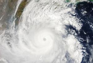
According to the latest issue of an annual disaster statistics report, floods were the deadliest type of disasters in 2019, followed by extreme temperature, while storms affected the highest number of people. Published by the Centre for Research on the Epidemiology of Disasters (CRED), “Natural disasters 2019 - Now is the time to not give up” draws on data recorded in the Emergency Events Database (EM-DAT), which saw the addition of 396 disasters that affected a total of 95 million and caused $103 billion in economic losses around the world.
Accounting for 40 per cent of disaster events, Asia suffered the highest impact with 45 per cent of deaths and 74 per cent of total affected. India, which saw cyclone Fani cause destruction in 2019, was the country most...
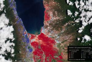
read more20/08/2020In September 2018, the Indonesian island of Sulawesi was hit by a 7.5 magnitude earthquake. The impact, combined with the tsunami, landslides, and soil liquefaction that followed, “... claimed well over 2000 lives, destroyed homes, buildings, infrastructure and farmland in several districts,” according to the European Space Agency (ESA).
Ten months later, response efforts are now moving into the recovery and rebuilding phase, with satellite information offering important insights to local officials. For example, through a collaboration with the Asian Development Bank, ESA is providing Indonesian officials with hazard-mapping tools derived from Earth observation data, and training in how to most effectively use these resources. “The main purpose of sharing these information products is to help the...
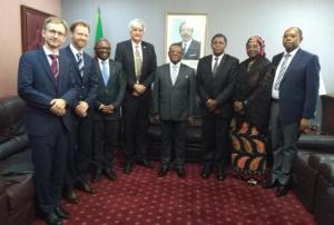
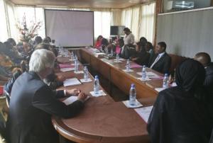
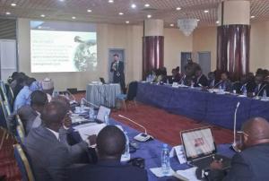
read more06/08/2019Upon the request of the Ministry of Territorial Administration (MINAT), Government of Cameroon, UN-SPIDER carried out a week-long Institutional Strengthening Mission (ISM) to Yaoundé from 15 to 19 July. The mission aimed to strengthen the capacities of the Department of Civil Protection (DPC) of Cameroon in using space-based information in all phases of the disaster management cycle. It was the third UN-SPIDER mission to Cameroon after a Technical Advisory Mission (TAM) in 2011 and an Institutional Strengthening Mission (ISM) in 2012, the latter including a training course on “Remote Sensing for Disaster Management”.
During the mission, UN-SPIDER experts and an expert from its Nigeria Regional...
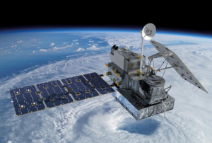
read moreRegional Support Offices mentioned:22/07/2019Five years ago, the National Aeronautics and Space Administration (NASA) and the Japan Aerospace Exploration Agency (JAXA) launched the Global Precipitation Measurement (GPM) Core Observatory as a joint satellite. Since then, the instruments on GPM have provided advanced measurements about rain and snow particles within clouds, Earth’s precipitation patterns, extreme weather and precipitation that affects communities around the world.
GPM was engineered to get data to scientists, operational and application users as soon as possible for societal benefits. It obtains data quickly using the Tracking and Data Relay Satellite (TDRS) 12-member satellite constellation, which serves as an information pipeline between Earth-orbiting satellites and NASA ground stations. On average, GPM can take one to three hours to get data into users’ hands, but in emergencies, the average delivery time can be shortened to between 15 and 90 minutes.
GPM’s main...
read more02/04/2019

