Germany

country taxonomy block

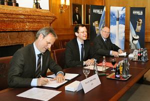
ESA and Eurockot today signed contracts for launching two ESA satellites: Sentinel-2A and Sentinel-3A will fly in 2013 on Rockot vehicles from the Plesetsk Cosmodrome in northern Russia for Europe’s GMES programme.


The contract signing by Matthias Oehm, Chief Executive Officer of Eurockot Launch Services GmbH, and Volker Liebig, Director of ESA’s Earth Observation Programmes, took place at the historic Chamber of Commerce of Bremen, Germany.
The Senator for Economics, Labour and Ports of the Free and Hanseatic City of Bremen, Martin Günthner, and the Chief Executive Officer of Astrium Space Transportation, Alain Charmeau, were also in attendance.

“With the launch of the first suite of Sentinels, a new era of Earth observation will start in Europe with the first worldwide operational monitoring system of environment and security,” noted Prof. Liebig.

Sentinel-2 and -3 are two of five Sentinel missions that ESA is…

more
Publishing date 09/02/2012

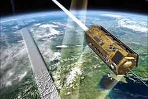
After a year in service, the German Earth observation satellite TanDEM-X, together with its twin satellite, TerraSAR-X, have completely mapped the entire land surface of Earth for the first time. The data is being used to create the world’s first single-source, high-precision, 3D digital elevation model of Earth. The German Aerospace Center (Deutsches Zentrum fur Luft- und Raumfahrt; DLR) controls both radar satellites, generates the elevation model and is responsible for the scientific use of TanDEM-X data. It is reminiscent of ballet on ice; throughout the last year, Germany’s radar satellites, TanDEM-X and TerraSAR-X, have been moving through space in close formation, at times just a few hundred metres apart. Strip by strip, they have recorded Earth from different angles and transmitted high-resolution radar data from their orbit at an altitude of 514 kilometres down to the three ground stations – Kiruna (Sweden), Inuvik (Canada) and O’Higgins (Antarctica…

more
Publishing date 17/01/2012

On June 14, RapidEye, a leader in wide area, repetitive coverage of Earth through its constellation of satellites announced that EyeFind, a tool that allows users to browse its entire archive, is now online. “We are very excited about rolling EyeFind out to our customers,” commented Frederik Jung-Rothenhausler, RapidEye’s Chief Technical Officer. “This is something we’ve developed internally, tested thoroughly and are quite confident in its ability and functionality. This is a major milestone which gives our distributors and direct customers an easy way to view every image we have.”

EyeFind allows customers to browse the entire RapidEye Library, its rapidly growing archive, based on date, cloud cover and product type. Advanced options allow for parameters to be entered on a map or for a shape file to be uploaded outlining an area of interest. Once the customer has located their needed images, an inquiry can be sent to RapidEye…

more
Publishing date 22/06/2011

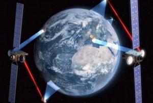
The contract signed between OHB System AG and Astrium Services is worth 7.4 million euros, or $10.7 million. The agreement gives OHB System authority to proceed with designing a satellite to fly in geostationary orbit more than 22,000 miles above Earth.The European Data Relay Satellite system will feature at least one dedicated spacecraft and a piggyback communications package to fly on a commercial broadcasting satellite.
OHB System will design and build the standalone EDRS platform in Bremen, Germany. Both spacecraft will use laser optical communications instruments to transmit up to 1.8 megabytes per second of data across distances of up to 25,000 miles, according to OHB System. The laser terminals will be built by Tesat-Spacecom, another German company.Germany is supplying the majority of the funding for the EDRS system. Astrium Services is overseeing its development.
The piggyback communications system should be launched in 2014 and the OHB System spacecraft will…

more
Publishing date 06/05/2011

The Disaster Management Tool (DMT) is a mobile field system that allows field workers and control center officers to interactively enter and retrieve information about the areas of interest. It uses sensors (like GPS receivers) for automatic data collection. It also allows an easy and fast flow of the situation information, also across organizational and jurisdictional boundaries. And finally, it provides dynamic and interactive situation maps and reliable data storage.

The basic idea of the DMT training, which was attended by one UN-SPIDER expert, was to explore opportunities for a follow-up pilot project together with the Institute for Communication and Navigation (IKN) at DLR and the Italian NGO: Cooperazione Internazionale – COOPI, UN-SPIDER’s partner within the Disaster Preparedness programme in the South East African and South West Indian Ocean (DIPECHO), funded by the European Commission - Humanitarian Aid & Civil Protection (ECHO). The envisaged…

more
Publishing date 04/04/2011

This document contains the proposed UN-SPIDER workplan for the biennium 2012-2013 to be considered by the Scientific and Technical Subcommittee at its Forty-eighth session in Vienna, 7-18 February 2011. It includes the use of space-based solutions in disaster management plans and policies and in the implementation of risk reduction activities.

Published by: UNOOSA
For further information visit: http://www.oosa.unvienna.org/pdf/limited/c1/AC105_C1_2011_CRP15E.pdf

more
Publishing date 17/02/2011

The GMES User Forum was organized by the German Federal Ministry of Transport, Building and Urban Development (BMVBS) together with the German Federal Ministry for the Environment, Nature Conservation and Nuclear Safety (BMU) and in close cooperation with the German Aerospace Center (DLR). It brought together about 120 participants from a large number of German institutions, national agencies, and leading private companies for discussions with high-level representatives from the European Commission and the German Government. The main intention of this meeting was to inform potential users about the already existing and upcoming GMES core- and downstream services and to better integrate national needs and networks into the further planning. After the opening session and the introductory presentations held by the head of the GMES office in Brussels, Ms. Christine BERG, and delegates from the organizing ministries, the group of participants was divided into four different thematic…

more
Publishing date 04/11/2010
On 22 July 2010, researchers at the German Aerospace Center (Deutsches Zentrum für Luft- und Raumfahrt; DLR) facility in Oberpfaffenhofen published the first 3D images from the TanDEM-X satellite mission. Just one month after the launch of TanDEM-X (TerrraSAR-X add-on for Digital Elevation Measurement), which took place on 21 June 2010, DLR researchers have created the first digital elevation model – almost a week ahead of schedule. A group of Russian islands in the Arctic Ocean was selected for the first test.

The first successful experiment is the starting point for more 3D images. Close approach of the satellites also allowed acquisition of test images at lower latitudes. Shortly after the first acquisition, the opportunity arose to image a 50 x 30 kilometre area in the southern Russian region of Kalach on Don, about 100 kilometres northwest of Volgograd. This area was the target of the very first TerraSAR-X radar acquisition.

more
Publishing date 23/07/2010

NSAU experts and specialists of space industry enterprises of Ukraine paid a working visit to German Aerospace Centre (DLR), leading research institutes and companies of the space spectrum of Germany in the framework of Twinning Space project within Feb.1 – Feb.6, 2010 in order to define further perspectives of bilateral cooperation.
In course of the visit Ukrainian delegation became acquainted with activities of German leading space sector companies: OHB Technology, EADS Astrium, Kayser Threde GmbH, IABG.

The working meetings with representatives of the German Space Operations Center (GSOC), National Communication and Navigation Institute, Institute of Robotics and Mechatronics, Institute of Space Systems. NSAU delegation was also invited to German Remote Sensing Data Center and Galileo Control Center (European Global Satellite Navigation System).

The main topic of all working meetings was discussion of the present state and determining of cooperation…

more
Publishing date 24/02/2010
Regional Support Offices mentioned:


On October 14, 2009, the International Day for Disaster Reduction was used to illustrate the role of UN-SPIDER in a concrete case, namely the recent Tropical Cyclone on the Philippines. At the VIC Rotunda in Vienna, a presentation was given on the particular example. After a welcome address by Niklas Hedman (Chief Committee Services and Research Section, Office for Outer Space Affairs) and introductory remarks on space and disaster management by Juan Carlos Villagran (UN-SPIDER), Mr. Manangan, Minister at the Permanent Mission of the Philippines, presented his observations on the recent disaster and its management. Ms. Gerardo, Chair of the VIC Club Filipino, expressed her thanks for the contributions made for the people in the Philippines. Michael Leitgab (UN-SPIDER) then explained the role of UN-SPIDER in the case of the recent Tropical Cyclone, and Niklas Hedman gave the concluding remarks to close the event. In Bonn, the UN-SPIDER…

more
Publishing date 28/10/2009

The Japanese Aerospace Exploration Agency (JAXA) and the German Aerospace Center (DLR) today signed a Letter of Intent (LOI) concerning Mutual cooperation for satellite disaster monitoring.

In this LOI, both parties acknowledged the necessity to promote satellite application, especially Synthetic Aperture Radar (SAR) satellites, as well as related applied research, and to pursue such activities in an international manner.

For further information, please check:
http://www.jaxa.jp/press/2009/08/20090824_dlr_e.html

more
Publishing date 24/08/2009