Researchers from the Institute for Research on Social Issues and the Center for Urban Health of Indiana and Purdue University at Indianapolis recently published a study showing major advantages in using remote sensing assets for extreme heat vulnerability studies.
The unique nature of remotely sensed data is evident in the relatively systematic way information is collected when compared to the in situ measurements currently used. For example, a LandSAT 8 image is captured in a nearly instantaneous manner and it has a typical size of 198 km by 180 km: an impossible task for in situ measurements.
Remotely sensed data is very important to identify heat emergencies for a specific location. One method of doing so is to examine the percentile of temperature over a certain range of time and compare it to the forecast high temperature over the forthcoming days. Air temperature is presently taken by in situ measurements and collected within the confines of a standardized network of surface-based thermometers. Remote sensing allows for spatial variations which are clearly visualized in a remotely sensed thermal images, allowing for improved decision-making or preparedness for extreme heat events.
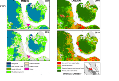
The study points out that advances need to be made in the collection of satellite-based thermal data. Currently, the Moderate Resolution Imaging Spectroradiometer (MODIS) and Visible Infrared Imaging Radiometer Suite (VIIRS) in the Earth Observation Constellation collect thermal data on a daily basis, with a satisfactory temporal resolution but an inadequate spatial resolution for the examination of local-scale variations. The research shows differences between MODIS and Landsat in the spatial resolution and suggests a multi-sensor fusion framework to give a potential support to decision-making in both temporal and spatial context of heat event.
The study shows that, even if remote sensing has limitations, it provides an alternative view of spatial characteristics and a level of awareness that is lacking in field-based temperature assessments. Researchers and public health professionals will further exploit the usefulness and availability of such datasets.

