United
Nations
Office for Outer Space Affairs
UN-SPIDER Knowledge Portal
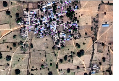
A joint project between DigitalGlobe and many volunteers has helped in the eradication of polio through mapping of villages in developing countries during vaccination campaigns. The mapping of the often isolated settlements was complicated and apart from analysing big data captured by satellites, DigitalGlobe had to rely on volunteers and crowdsourcing based on the Tomnod programme. The final result is a map covering 285,103 villages in Nigeria, Somalia, Pakistan and Afghanistan.
These maps are used to ensure that vaccination campaigns have the required data to search for everyone who needs to be immunized against the illness and know the amount of medical doses and human staff that ought to be sent. In the past two months polio was finally eliminated from the whole African continent after it disappeared from Nigeria and Somalia. Only two countries remain with the presence of this disease: Pakistan and Afghanistan.
DigitalGlobe is involved in the delivery of satellite imagery for global development institutions about agricultural activities, refugee camps, environmental data or natural disasters.
