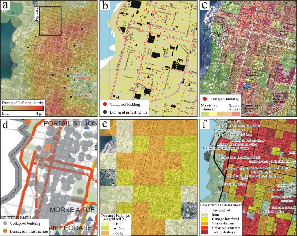
By spatially extensive events, ground-based mapping is too slow, typically hindered by disaster-related site access difficulties, or too dangerous as in the case of potential radioactive contamination resulting from the March 2011 earthquake and tsunami disaster in Japan. Remote sensing has long been seen as a potential solution. Essentially, any type of platform-sensor combination is capable of providing some form of useful view on a disaster scene. However, optimal remote sensing strategies that consider the actual information needs of specific stakeholders, the technical utility of a given platform and sensor with respect to the types of infrastructure and damage present, as well as temporal and environmental limitations, are harder to determine.
While damage map generation based on Charter data has long been a routine activity, recent disaster events have highlighted (i) limitations in the process, (ii) newly emerging and potentially competitive methods, and (iii) a far wider field of stakeholders (both map producers and users) than ever before. At the same time we are seeing a democratization of geodata and –tool access, which, together with growing spatial literacy outside the professional geoinformatics domain, also offers the potential for more collaborative damage mapping. The suitability and potential challenges of such approaches are addressed in this article.