Civil protection authorities need guidance in order to establish comprehensive emergency plans for tsunami-prone communities. In particular, the safe evacuation of all potentially affected persons prior to the arrival of the first devastating tsunami wave should be the primary goal in case of a tsunami alert.
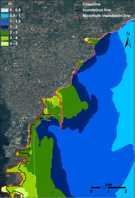
Tsunami hazard scenarios are built up by specifying the various characteristics of one or more tsunamigenic sources (possibility of earthquakes and sub-marine landslides, historical earthquakes and sub-marine landslides). Through computer simulations, the oceanic tsunami wave propagation (arrival time of first tsunami wave on land, time intervals between the various waves) and its local effects on land (extent of inundation, wave heights) can be calculated. Hence, as basic input to the generation of tsunami evacuation plans, the expected flooded areas and the expected maximum wave height in these areas will be exploited in order to define the maximum number of affected persons and the time constraints to evacuate these persons onto safe areas.
Evacuation is usually done on basis of well developed evacuation plans that operate on a given topography. This may be counterchecked through mathematical simulation, and further optimization of the plan may be achieved through the inclusion of additional safe areas (shelters) and/or appropriate escape routes within the plan. Recent research carried out in the framework of the European SCHEMA project suggests the inclusion of hazard and damage scenarios as these may identify suitable vertical shelters, suitable escape routes and even expected accumulation of debris.