• English
  • Español
  • Français

United
Nations


Office for Outer Space Affairs
UN-SPIDER Knowledge Portal

  • Home
  • About Us
    • What is UN-SPIDER?
    • About UNOOSA
    • Publications
    • Jobs
    • Meet the Team
    • Contact
  • Space Application
    • Satellite Technology
    • Emergency Mechanisms
    • Recovery Mechanisms
    • International Asteroid Warning Network
    • Space Mission Planning Advisory Group
    • International Space Weather Initiative
    • Space Technologies in the UN
    • User Stories
  • Links & Resources
    • Data Applications
      • Disaster Recovery
    • Data Sources
    • GIS and Remote Sensing Software
    • Online Learning Resources
    • Institutions
  • Risks & Disasters
    • Disaster Risk Management
    • Early Warning Systems
    • Emergency and Disaster Management
    • Natural Hazards
    • Sendai Framework
    • The UN and Disaster Risk Management
    • The UN and Early Warning
    • The UN and Disaster Management
  • Advisory Support
    • Advisory Missions
    • Emergency Support
    • Virtual Advisory Support
    • Recommended Practices
    • Training Activities
    • Practical Uses
  • Network
    • Regional Support Offices
    • GP-STAR
    • MHEWS
    • IWG-SEM
  • Projects
    • SPEAR
    • SEWS-D
    • EvIDENz
    • Flood GUIDE
    • CommonSpace Initiative
    • Tonga Pilot Project
  • News & Events
    • News
    • Events Calendar
    • UN-SPIDER Events Archive

Breadcrumb

  • Home
  • News and Events
  • View Active News
  • New Tool For Global Severe Index Allows Climate Community To Assess Meteorological Drought By Terrestrial Water Storage
  • New tool for global severe index allows climate community to assess meteorological drought by terrestrial water storage

New tool for global severe index allows climate community to assess meteorological drought by terrestrial water storage

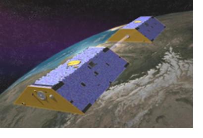
Artist's concept of Gravity Recovery and Climate Experiment. Image: NASA/JPL-Caltech

A new technique has been developed to help mitigate the effects of drought. The satellite-based drought severity index (DSI) has been created using terrestrial water storage changes from the Gravity Recovery and Climate Experiment (GRACE) to help identify the timing, extent and severity of droughts for adequate relief efforts.

The GRACE-DSI allows the comparison of data across regions and periods, measuring soil-water balance models and meteorological data accurately. This technology also captures changes in water storage due to human impact, along with groundwater extractions that alter land surface course and impact water management.

The extensive coverage of GRACE-DSI facilitates a better assessment of hydrological droughts on a regional and global scale. GRACE-DSI complements traditional drought monitoring metrics like the Palmer Drought Severity Index (PDSI) supporting data on water storage that influences soil moisture restoration and drought recovery. This is particularly useful in researching the spread of droughts.

In places where ground readings can be particularly challenging to collect, the GRACE-DSI is able to provide globally consistent drought monitoring data based on satellite gravity observations. In addition, the GRACE-DSI can be useful for studying water-plant interactions, looking at the variations in plant roots and seasonal characteristics of water supply stresses that influence vegetation growth.
New satellite-based global drought severity index unveiled by researchers
Wed, 11 Apr 2018 - 13:53

Footer menu

  • Contact
  • Terms of Use

User account menu

  • Log in