As tropical cyclone Debby-12 is approaching Florida, the state of emergency was declared yesterday, 25 June 2012. Debby is expected to have a low humanitarian impact based on the maximum sustained wind speed and the affected population and their vulnerability.
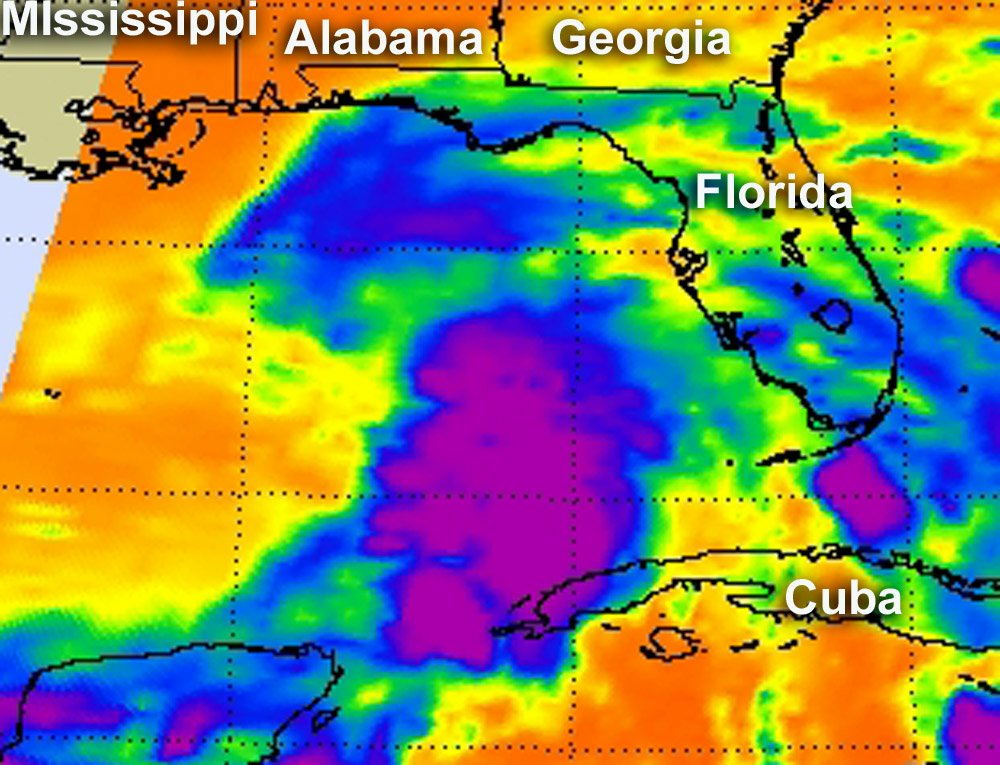
Debby was born Saturday, June 23 around 4 a.m. EDT as her maximum sustained winds whipped up to 50 mph very quickly. She was born about 220 miles (355 km) south-southeast of the mouth of the Mississippi River, near 26.2 North and 87.6 West. Debby was moving to the north at 6 mph (9 kmh). In an infrared image taken on June 23 from the Atmospheric Infrared Sounder (AIRS) instrument on NASA's Aqua satellite, the bulk of showers and thunderstorms (heaviest rainfall and strongest t-storms) were seen north, east and south of the center of circulation. By the next day, Sunday June 24 at 8 a.m. EDT, Debby's maximum sustained winds were near 60 MPH (95 kmh), and Debby was located about 170 miles (270 km) southeast of the mouth of the Mississippi River. That's about 195 miles southwest of Apalachicola, Fla. Debby slowed to a crawl in a northerly direction at 2 mph (4 kmh). By early Monday, June 25, Debby was almost stationary in the Gulf of Mexico bringing heavy rain, storm surge, tropical-storm-force winds to several Gulf states.