• English
  • Español
  • Français

United
Nations


Office for Outer Space Affairs
UN-SPIDER Knowledge Portal

  • Home
  • About Us
    • What is UN-SPIDER?
    • About UNOOSA
    • Publications
    • Jobs
    • Meet the Team
    • Contact
  • Space Application
    • Satellite Technology
    • Emergency Mechanisms
    • Recovery Mechanisms
    • International Asteroid Warning Network
    • Space Mission Planning Advisory Group
    • International Space Weather Initiative
    • Space Technologies in the UN
    • User Stories
  • Links & Resources
    • Data Applications
      • Disaster Recovery
    • Data Sources
    • GIS and Remote Sensing Software
    • Online Learning Resources
    • Institutions
  • Risks & Disasters
    • Disaster Risk Management
    • Early Warning Systems
    • Emergency and Disaster Management
    • Natural Hazards
    • Sendai Framework
    • The UN and Disaster Risk Management
    • The UN and Early Warning
    • The UN and Disaster Management
  • Advisory Support
    • Advisory Missions
    • Emergency Support
    • Virtual Advisory Support
    • Recommended Practices
    • Training Activities
    • Practical Uses
  • Network
    • Regional Support Offices
    • GP-STAR
    • MHEWS
    • IWG-SEM
  • Projects
    • SPEAR
    • SEWS-D
    • EvIDENz
    • Flood GUIDE
    • CommonSpace Initiative
  • News & Events
    • News
    • Events Calendar
    • UN-SPIDER Events Archive

Breadcrumb

  • Home
  • News and Events
  • View Active News
  • IRNSS Satellite To Help Locate Lost Trekkers.
  • IRNSS satellite to help locate lost trekkers.

IRNSS satellite to help locate lost trekkers.

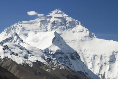
IRNSS satellite to help locate lost trekkers. Image courtesy of Luca Galuzzi from Wikipedia article "Himalayas"IRNSS satellite to help locate lost trekkers. Image courtesy of Luca Galuzzi from Wikipedia article "Himalayas"

The Indian Space Research Organization launched on the 28 April 2016 the seventh satellite (IRNSS 1G) of the Indian Regional Navigation Satellite System (IRNSS). Being a navigation satellite, this system is likely to be of immense help in finding lost trekkers in the Himalayan ranges, according to the experts.

This satellite can play an important role in the different phases of the risk management cycle, providing information and tracking natural hazards in order to protect population said the Uttarakhand Space Application Centre (USAC).

Durgesh Pant, the director of USAC, said: "We faced a lot of problems in using the US-based satellite systems here in the past. With our very own satellite system now for navigation, numerous other applications could also be used in the near future. Considering the topography of Uttarakhand, this launch is likely to help us track adventure enthusiasts, tourists and pilgrims who are in danger”.

The Director also commented regarding how location-based services through this system could aide rescuers with information about wounded people especially during major events in the region such as Char Dham, one of the biggest pilgrimages in India. 
IRNSS satellite to help locate lost trekkers, disaster management
Fri, 20 May 2016 - 08:45
India

Footer menu

  • Contact
  • Terms of Use

User account menu

  • Log in