United
Nations
Office for Outer Space Affairs
UN-SPIDER Knowledge Portal
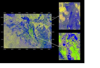
The Japan Aerospace Exploration Agency’s (Jaxa) supplied remote sensing data to the International Water Management Institute (IWMI) to elaborate an up-to-date map of the Sudd, one of the largest tropical wetlands in the world located in South Sudan. The project was carried out in the framework of JAXA's Kyoto and Carbon (K&C) Initiative."The wetland as a whole and its dynamics have not been mapped repetitively or systematically," explains Lisa-Maria Rebelo, a researcher in remote sensing at IWMI and a member of the international science team set up to support the Initiative.
The long-wave band radar data acquired by the PALSAR instrument between 2006-2011 has the benefit of allowing scientists to see what’s happening beneath the vegetation canopy. "We get a very distinct signal between open water, flooded vegetation and terrestrial land," says Rebelo. "This gives us a much clearer picture, compared to optical data, for looking at the dynamics of the different wetland components, and inundation patterns and dynamics."
