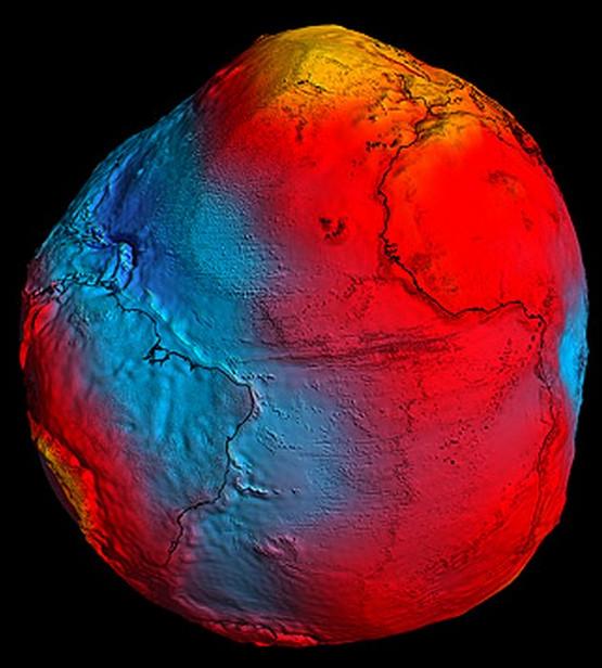
After just two years in orbit, ESA's GOCE satellite has gathered enough data to map Earth's gravity with unrivalled precision. Scientists now have access to the most accurate model of the 'geoid' ever produced to further our understanding of how Earth works.The new geoid is the surface of an ideal global ocean in the absence of tides and currents, shaped only by gravity. It is a crucial reference for measuring ocean circulation, sea-level change and ice dynamics – all affected by climate change.
The GOCE geoid will make advances in ocean and climate studies, and improve our understanding of Earth’s internal structure. For example, the gravity data from GOCE are helping to develop a deeper knowledge of the processes that cause earthquakes, such as the event that recently devastated Japan.
Since this earthquake was caused by tectonic plate movement under the ocean, the motion cannot be observed directly from space. However, earthquakes create signatures in gravity data, which could be used to understand the processes leading to these natural disasters and ultimately help to predict them.