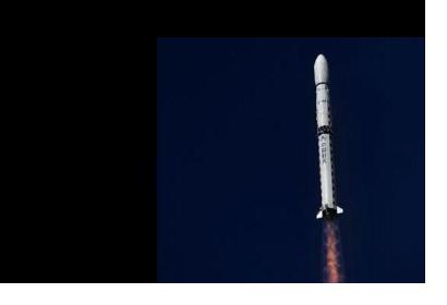
The fifth cooperative mission between China and Brazil, CBERS (China-Brazil Earth Resources Satellite), was launched at 03:26 UTC on Sunday 7 December 2014.
CBERS-4 will operate on a sun-synchronous orbit at 778 km altitude with an inclination of 98.504 deg and 100.26-minute orbital period.
CBERS-4 carries four cameras in the payload module, with improved geometrical and radiometric performance: MUXCam, PanMUX, IRS and WFI.
MUXCam is a multispectral camera with four spectral bands covering the wavelength range from blue to near infrared (from 450 nm to 890 nm) with a ground resolution of 20 m and a ground swath width of 120 km, designed to provide imagery for cartographic applications.
The PanMUX (Panchromatic and Multispectral Camera) is a CCD pushbroom camera that delivers panchromatic images with 5m GSD (Ground Sample Distance) and three band multispectral images with 10 m GSD. It has a swath width of 60 km, a side-viewing capability of ±32º as well as focal plane adjustment and on-orbit calibration capabilities.
The IRS (Infrared System) or IRMSS-2 (Infrared Multispectral Scanner-2) is an imager with 4 spectral bands and it has a spatial resolution which is halved with regard to IRMSS.
The WFI (Wide-Field Imager) features four spectral bands with a ground resolution of 64 m at nadir and a ground swath of 866 km. This camera will be used for remote sensing of the Earth and it is aimed to work at an altitude of 778 km.
Beside these cameras, CBERS-4 is equipped with the DCS (Data Collection System) and the SEM (Space Environment Monitor).

