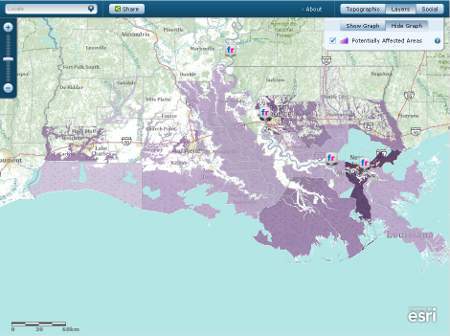
Esri has created a map showing parishes within the Federal Emergency Management Agency (FEMA) 100-year flood zone in Louisiana (USA). FEMA is a government body supporting citizens and first responders in case of disasters and hazards. The map shows flood impact and adds more data.
The flood area is displayed and when clicking on the parishes, a graph with demographics and the spread of the population over various age groups will be shown. Images, videos and tweets can be displayed using the ‘social' button.
Another map shows the latest developments and anticipation on floods and there are links to various resources on forecasts, flood data, emergency management and fact sheets.