  • English
  • Español
  • Français

United
Nations


Office for Outer Space Affairs
UN-SPIDER Knowledge Portal

  • Home
  • About Us
    • What is UN-SPIDER?
    • About UNOOSA
    • Publications
    • Jobs
    • Meet the Team
    • Contact
  • Space Application
    • Satellite Technology
    • Emergency Mechanisms
    • Recovery Mechanisms
    • International Asteroid Warning Network
    • Space Mission Planning Advisory Group
    • International Space Weather Initiative
    • Space Technologies in the UN
    • User Stories
  • Links & Resources
    • Data Applications
      • Disaster Recovery
    • Data Sources
    • GIS and Remote Sensing Software
    • Online Learning Resources
    • Institutions
  • Risks & Disasters
    • Disaster Risk Management
    • Early Warning Systems
    • Emergency and Disaster Management
    • Natural Hazards
    • Sendai Framework
    • The UN and Disaster Risk Management
    • The UN and Early Warning
    • The UN and Disaster Management
  • Advisory Support
    • Advisory Missions
    • Emergency Support
    • Virtual Advisory Support
    • Recommended Practices
    • Training Activities
    • Practical Uses
  • Network
    • Regional Support Offices
    • GP-STAR
    • MHEWS
    • IWG-SEM
  • Projects
    • SPEAR
    • SEWS-D
    • EvIDENz
    • Flood GUIDE
    • CommonSpace Initiative
  • News & Events
    • News
    • Events Calendar
    • UN-SPIDER Events Archive

Breadcrumb

  • Home
  • Links and Resources
  • GIS and Remote Sensing Software
  • EnMAP-Box
  • EnMAP-Box

EnMAP-Box

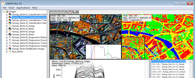
Description:The EnMAP box is a freely available software to process and analyze remote sensing data. The main features include an easy-to-use GUI, visualization, Support Vector Machines and Random Forest based classification and regression, and vegetation indices calculation.
EnMAP is the Environmental Mapping and Analysis Program, a German hyperspectral satellite mission in order to monitor and characterize the Earth's environment on a global scale. In this context, the EnMAP-Box was developed as a platform-independent software for processing hyperspectral remote sensing data and particularly to handle data from the EnMAP sensor.
Software type:Desktop image processing (remote sensing software - raster data)
Website:http://www.enmap.org/?q=enmapbox
Accessibility:Install only
Requirements:
  • Free download of the EnMAP-Box.
  • IDL Virtual Machine is required. Download of ENVI or IDL possible after creating an account at http://www.exelisvis.com/.
Computer System:Windows, MacOSX, Linux
Scope:Image processing, Modelling, Visualisation
Vector/Raster:Raster
Optical data or radar data format:Optical
Graphical user interface:Yes
Costs:Free
Tutorials:
  • Application Tutorial - Regression Techniques
  • Application Tutorial

Footer menu

  • Contact
  • Terms of Use

User account menu

  • Log in