Switzerland

country taxonomy block

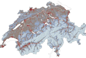
The Swiss Seismological Service (SED) at ETH Zürich introduced on March 7 the first seismic risk model for Switzerland. The new model, that complements the Seismic Hazard Map published by SED in 2004, shows the potential impact of earthquakes on the population and infrastructure in the country. The seismic risk model, that combines information about earthquake risk, effects of the local substrate, building vulnerability, and affected persons and assets, is freely available to the public. The model is intended to help government agencies make informed decisions in the face of disaster preparedness and disaster management. 

Based on the seismic risk model, it is estimated that destructive earthquakes in the…

more
Publishing date 15/03/2023

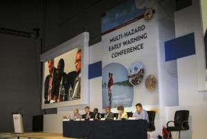
Held on 13 and 14 May in Geneva, the Second Multi-Hazard Early Warning Conference (MHEWC-II) called for further strengthening of multi-hazard early warning systems (MHEWS) as part of disaster risk reduction efforts worldwide. At the event, more than 320 participants from all regions of the world and affiliated to international, regional, national and local public sector, civil society, private sector and academic institutions highlighted the need for better governance, partnerships, communication and science and technology for multi-hazard early warning efforts to translate into early action that saves lives. Establishing effective early warning systems that address intertwined hazards is becoming more urgent by the day against the backdrop of a changing climate and extreme weather events that particularly affect developing countries.

MHEWC-II, which was hosted by the World Meteorological Organization (WMO) at its headquarters in Geneva…

more
Publishing date 23/05/2019

The International Network for Multi-Hazard Early Warning System (IN-MHEWS) is convening the Second Multi-Hazard Early Warning Conference (MHEWC-II) on 13 and 14 May 2019 as a pre-event to the sixth session of the Global Platform for Disaster Risk Reduction (GP2019) in Geneva. The conference aims to highlight the role of national governance in the implementation and sustainability of multi-hazard early warning systems that take into account fundamental information on all risk dimensions (hazard, exposure, vulnerability and coping/adaptive capacity), regulatory frameworks and policies, and institutional partnerships, and ensure that warnings are received, well understood and actionable.

The conference, which will take place at the Headquarters of the World Meteorological Organization (WMO), is the second of its kind after the First Multi-Hazard Early Warning Conference (MHEWC-I) in 2017 in Cancun, Mexico.…

more
Publishing date 30/04/2019

From 19 to 21 April 2016 the World Meteorological Organization (WMO) conducted the first meeting of the WMO Disaster Risk Reduction User-Interface Expert Advisory Group on Multi-Hazard Early Warning Systems.  The meeting took place in the Headquarters of WMO and UNOOSA was invited to participate along with experts from selected UN organizations, IFRC, and meteorological departments of Member States of Europe, Africa, Asia and Latin America.  The meeting was used by WMO to discuss the notions of Multi-Hazard Early Warning Systems (MHEWS), to update the WMO guidelines for institutional roles and partnerships in MHEWS; and to provide guidance to WMO in its efforts related to the International Network on Multi-hazard Early Warning Systems (IN-MHEWS) which was launched in Sendai, Japan in 2015 by WMO, UNOOSA and other partners. 

Issues discussed in this meeting included the notion of using color-coded warnings (green, yellow, red for example) as a…

more
Publishing date 16/05/2016

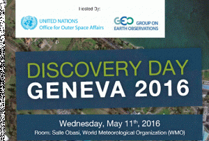
The United Nations Office for Outer Space Affairs (UNOOSA) and the Group of Earth Observations (GEO), with the support of DigitalGlobe, are organizing the Discovery Day 2016 meeting in Geneva on the 11th of May 2016 at the headquarters of the World Meteorological Organization.  It  will provide a high-level perspective on the benefits and applications of space-based imagery and space-derived geospatial information to monitor the effects of climate change, in environmental and natural resource management, and to respond to emergencies and crisis events.

The organizers will present how collaboration around the provision of VHR satellite imagery and geospatial analysis can support the work of various UN entities and other international organizations in implementing their respective mandates and how it can facilitate inter-agency coordination. DigitalGlobe will demonstrate state-of-the-art satellite Earth observation, including WorldView-3, launched into…

more
Publishing date 06/05/2016
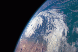
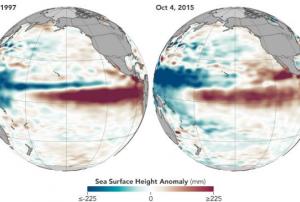
During a news conference in Geneva on 16 November 2015, the Secretary-General of the United Nations World Meteorological Organization (WMO), Mr. Michel Jarraud, commented that the “Severe droughts and devastating flooding being experienced throughout the tropics and sub-tropical zones bear the hallmarks of this El Niño, which is the strongest for more than 15 years.” He further emphasized that “We are better prepared for this event than we have ever been in the past.”
 
During the next months, El Niño is expected to strengthen to become one of the three strongest reported El Niño events within the last 65 years. Most affected countries are already taking national preparation efforts in agriculture, fisheries, water and health, as well as disaster management, to enlighten population, save lives, and to reduce the risk of economic damage, based on advice from National…
more
Publishing date 17/11/2015

On 14 October at the World Humanitarian Summit Global Consultation in Geneva, the satellite operators Eutelsat, Hispasat, Inmarsat, Intelsat, SES, Thuraya and Yahsat signed the Crisis Connectivity Charter in partnership with the UN Office for the Coordination of Humanitarian Affairs (OCHA) and the Emergency Telecommunications Cluster (ETC).

In the past years global natural disasters showed an increasing need for safe communication in the face of crisis. Therefore the Crisis Connectivity Charter formulates terms and protocols to enhance emergency response through the access of satellite-based communications. In times of crisis, satellite-based communication serves as a first instance to organize and facilitate logistics, medical care and emergency relief.

The principles of the charter focus on the access to satellite-based communication for humanitarian assistance during disaster management and the access to pre-positioned satellite equipment. Further the…

more
Publishing date 16/10/2015

On October 07, the head of the UN Office for Disaster Risk Reduction (UNISDR) in Geneva, Margareta Wahlström stressed the importance of investments in risk reduction to decrease the risk of potential flash floods in urban areas, as recently experienced in Guatemala, South Carolina (US) and the south of France.

Wahlström outlined that “Improvements in local weather forecasting can help improve early warnings. Risk and hazard mapping can identify potential disaster spots and motivate investment in resilient infrastructure including better flood course management and improved drainage systems.”

She further addressed the need to familiarize people with local land features of their living and working areas. Local knowledge will be as well the central issue on the upcoming International Day for Disaster Reduction on 13 October and is a key element of…

more
Publishing date 12/10/2015

The United Nations Office for Outer Space Affairs (UNOOSA) is pleased to announce an agreement with the Swiss Government to support the development of new initiatives to advance the use of space-based tools and technology in the various areas of work of Geneva-based United Nations entities, international organisations or non-governmental organisations.

Funded by the Federal Department of Foreign Affairs and the Federal Department of Environment, Transport, Energy and Communications, the  agreement aims at increasing awareness of the benefits of space-based tools and technology for environment and natural resource management, humanitarian affairs, peace building and security. Switzerland, a Member State of the Committee on the Peaceful Uses of Outer Space (COPUOS), hopes through this collaboration to strengthen the capabilities of Geneva-based entities in using space-based data, information, products and services

This collaboration will also support the work of UNOOSA,…

more
Publishing date 28/08/2015

Two representatives of UN-SPIDER attended the second Preparatory Committee meeting (PrepCom2) related to the Third United Nations World Conference on Disaster Risk Reduction (WCDRR), scheduled to take place in March 2015 in Sendai, Japan. PrepCom2 took place on 17 and 18 November in Geneva and served to approve the Conference programme of work and develop the draft post-2015 framework for disaster risk reduction.

During the first preparatory session in Geneva on 14 and 15 July 2014, participants had already agreed on a draft agenda and proposed rules of procedure for adoption regarding the WCDRR. Participants of the PrepCom sessions include representatives of Member States, intergovernmental organizations, UN system…

more
Publishing date 17/11/2014

The upcoming Third World Conference on Disaster Risk Reduction (WCDRR) in Sendai, Japan, in March 2015 is expected to bring together more than 6,000 stakeholders from government agencies, international and regional organizations, the private sector, civil society and non-government agencies. Its main outcome is expected to be a post-2015 framework for disaster risk reduction (Hyogo Framework for Action 2 - HFA-2).

Recognizing the relevance of such a global event, UN-SPIDER has been working with more than 15 partners from the Earth Observation community and from UN and other international, regional and national organizations from Asia, Africa, America, the Caribbean and Europe to promote the use of Space-based information at WCDRR. In doing so, in September 2014, UN-SPIDER and several partners have approached selected government agencies requesting their support…

more
Publishing date 02/10/2014

On 24 August 2014, the 5th International Disaster and Risk Conference IDRC 2014 started in Davos, Switzerland. This year's topic is "Integrative Risk Management - The role of science, technology & practice".

Over 1000 participants including business leaders, decision makers, practitioners, UN-, IO- & NGO-agents and scientists from more than 100 countries are attending ICRD 2014 to share and discuss new findings and experiences about the broad spectrum of risks societies are facing today.

IDRC included a special session on "Space Observation, GIS and Risk Mapping, which took place on Monday, 25 August. It was chaired by the GEO Secretariat. The presentations held during the session are available online and include topics such as "Potential of satellite data in catastrophic flood risk mapping and assessment: Case studies from Asia…

more
Publishing date 27/08/2014

On 14 and 15 July 2014, Member States and major groups convened in Geneva, Switzerland for the First Session of the Preparatory Committee of Third United Nations World Conference on Disaster Risk Reduction (WCDRR) to provide clear guidance and inputs to what the post-2015 framework should look like. In March 2015, Member State delegations will come together during the WCDRR in Sendai, Japan, and will agree on a global post-2015 framework for disaster risk reduction.

The preparatory meeting in Geneva included a plenary session during which the United Nations Office for Disaster Risk Reduction (UNISDR) requested the endorsement of several planning documents related to the conference. Member States and regional and international organizations as well as other groups made official statements. Some of these statements included the explicit mention regarding access to and use of geospatial data as a way to…

more
Publishing date 17/07/2014

Dr. Simonetta di Pippo, Director of the United Nations Office for Outer Space Affairs (OOSA), was in Geneva, Switzerland, between 24 and 27 June 2014 to meet with high level representatives of sister agencies of the United Nations system, other international organizations in Geneva and with the Government of Switzerland.

She explored opportunities for collaboration in the sector of space tools and applications. The meetings helped assess the requirements for support from those agencies in the use of space data and products in the realisation of their respective mandates, while at the same time raise the visibility of the Office, its programmes and its initiatives.

Ms Di Pippo met with representatives of the CERN, GCOS, GEO, ITU, ODA, OCHA, UNECE, UNEP, UNISDR, UNITAR/UNOSAT, UNOG, WHO, the Swiss Space Centre of the École Polytechnique Fédérale de Lausanne and of the Government of Switzerland. Short-term actions were agreed-upon to develop joint initiatives with some of…

more
Publishing date 30/06/2014

The proceedings of the Fourth Session of the Global Platform for Disaster Risk Reduction are now available. The Platform, a biennial forum with the latest goal of improving implementation of disaster risk reduction through better communication and coordination amongst stakeholders, had taken place in Geneva in May 2013. After four days of presentations and discussions, the Fourth Session called for a shared vision and commitment for the next 30 years.

Among its contributions, the Fourth Session has given some critical advice for the preparation of the post-2015 framework for disaster risk reduction, commonly called "HFA2", compiled in the proceedings. Some of the specific recommendations that were made include to ensure greater recognition…

more
Publishing date 16/08/2013

The Fourth Session of the Global Platform took place from 19 to 23 May 2013 in Geneva, Switzerland. Two of the main output documents are now available: The Chair's Summary and the Communiqué of the High-Level Dialogue.

This final Chair's Summary is a comprehensive account and concise report that highlights the key messages that emerged and comments made following the Fourth Session of the Global Platform for Disaster Risk Reduction.

The Global Platform for Disaster Risk Reduction is a biennial forum for information exchange, discussion of latest development and knowledge and partnership building across sectors, with the goal to improve implementation of disaster risk reduction through better communication and coordination amongst stakeholders. Hosted by the United Nations…

more
Publishing date 18/06/2013

Japan will host the world conference slated to be held next year at which countries will adopt the successor to the current global blueprint for disaster risk reduction efforts,  as announced today at the Fourth Session of the Global Platform for Disaster Risk Reduction that wrapped up in Geneva.

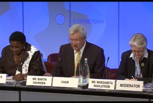
Delegates at the event called for immediately starting work on developing targets and indicators to monitor the reduction of risk, ahead of next year’s conference, to be held in the Japanese city of Sendai. Martin Dahinden, Director-General of the Swiss Agency for Development and Cooperation and Chair of the Global Platform, said the three-day meeting confirmed that the process to develop a successor to the Hyogo Framework is well underway.“There is consensus that the new instrument should build on the HFA and introduce the necessary innovations to address the challenges of increasing risk over the next 20 to 30 years,” he stated.


The 10-year…

more
Publishing date 24/05/2013

In a recent article on their website, UNDRR, the United Nations Office for Disaster Risk Reduction, highlights the discussions revolving around the role of space-based information for the post-2015 disaster risk reduction framework. The discussions had taken place during an interactive forum on 14 March 2013 in Geneva.

"We need to make these technologies more accessible and educate people on the benefits of new technologies to reduce disaster risks and support resilience building," remarked UNDRR's Deputy Director Helena Molin-Valdes, who also coordinates the Making Cities Resilient campaign which has signed up over 1300 cities. "The question now is how do we link spaced-based technologies, and the information they capture, to the wider issue of disaster risk reduction and long-term sustainable development? Will urban planners, engineers, and development practitioners step up to the challenges of openly sharing data, building capacities, partnering and…

more
Publishing date 19/04/2013

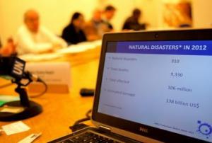
The UN Office for Disaster Risk Reduction (UNISDR) last week stated that for the first time in history the world has experienced three consecutive years where annual economic losses have exceeded $100 billion due to an enormous increase in exposure of industrial assets and private property to extreme disaster events.

UNISDR Director, Elizabeth Longworth, speaking at a press briefing on 14 March 2013, said: "A review of economic losses caused by major disaster events since 1980 shows that since the mid-90s there has been a rise in economic losses and this has turned into an upward trend as confirmed by the losses from last year when, despite no mega-disaster such as a major urban earthquake, economic losses are conservatively estimated in the region of $138 billion."

It's happened on nine occasions since including the last three years: 2010 ($138 bn), 2011 ($371 bn) and 2012 ($138 bn). Some 310 disasters killed over 9,300 people in 2012 and affected 106…

more
Publishing date 21/03/2013

The United Nations Convention to Combat Desertification (UNCCD) and World Meteorological Organization (WMO) have kicked-off the 2013 global campaign to drought preparedness and risk management on 13 March during the High-level Meeting on National Drought Policy, which takes place on 11-15 March 2013 in Geneva.

“Droughts have devastating effects on people, on livelihoods, the economy. However, current response to drought is too little and too late. We are starting a global campaign on raising awareness by calling to set up policies, mechanisms and systems that will pre-empt future devastating impacts of drought. Our call is “Do not let our future dry up”, said UNCCD Executive Secretary Luc Gnacadja.

The event under the title “Practical Steps to Drought Preparedness and Risk Management” kicked off the 2013 World Day to Combat Desertification, the UN Decade for Deserts and the Fight against Desertification and the UN Decade on Biodiversity.…

more
Publishing date 18/03/2013

Under the umbrella of the thirty-third session of the United Nations Inter-Agency Meeting (IAM) on Outer Space Activities this week in Geneva, UNOOSA and the United Nations Office for Disaster Reduction (UNISDR) organized the 10th Open Informal Session entitled: "Space and Disaster Risk Reduction: Planning for Resilient human settlements."

The session was inaugurated by Ms. Margareta Wahlström, Special Representative of the Secretary-General (SRSG) for Disaster Risk Reduction; Mr. Niklas Hedman, Chief of the Committee Policy and Legal Affairs Section of the United Nations Office for Outer Space Affairs and Ms. Helena Molin-Valdes, Coordinator of the “Making Cities Resilient Campaign” of the United Nations International Strategy for Disaster Reduction.

The session, open to delegations of Member States and other organizations of the United Nations system, included two panels…

more
Publishing date 15/03/2013

The 33rd session of the UN Inter-agency Meeting on Outer Space Affairs was inaugurated in Geneva, Switzerland this morning. The three-day event is intended for discussion of current and future activities, emergent technologies of interest and other related matters. The meeting issues a report on it deliberations for the consideration of the United Nations Committee on the Peaceful Uses of Outer Space, the primary UN body that deals with peaceful uses of space and international cooperation in outer space. The meeting also produces, on behalf of the Secretary-General, a report on the coordinated space-related activities of the UN system.

On 12 March 2013 - the first day of the event - a full-day open informal session with participation of Member States was be organized on a theme related to space and disasters. This year's session focuses on "Space and disaster risk reduction:…

more
Publishing date 12/03/2013

Work is entering the final stages on UNISDR's new edition of the Global Assessment Report on Disaster Risk Reduction (GAR13) which will appear in May this year. It is already being hailed by many peer reviewers as a "pioneering" piece of work because of its focus on risk as a major blind spot for the private sector.

UNISDR Chief Margareta Wahlström, wrapping up a two-day meeting last week with the GAR13's Editorial Advisory Board, concluded that: "How the private sector and governments take on board the key findings of this report will influence trillions of dollars of investment in critical infrastructure in years to come. UNISDR expects that GAR13 will have a profound effect on how disaster risk is managed by major corporations and small and medium-sized enterprises in the future. We are looking to achieve a paradigm shift from simple business continuity planning and disaster response to integrating disaster risk reduction into business planning in the…

more
Publishing date 11/02/2013

The International Working Group on the use of Satellite data for Emergency Mapping (IWG-SEM) met at the GEO Secretariat/WMO in Geneva to develop joint communication schemes and guidelines for an improved international cooperation in emergency mapping during large scale disaster situations.

During the two day meeting on 15-16 October 2012 the creation of a dedicated communication and information portal was discussed. Furthermore, first ideas for the definition of an emergency mapping ontology as well as of respective products and formats to enable the exchange of mapping and analysis products were developed.

The working group, currently chaired by the Joint Research Center (JRC) of the European Commission, was established in April 2012…

more
Publishing date 25/10/2012

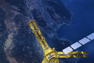
Archived radar data from the Envisat mission are playing an important role in mapping landslides in Switzerland. The mission’s vast archives continue to prove useful for mapping ground deformation. Landslides are a natural hazard of special relevance in Alpine regions. Earth-observing satellites – specifically those equipped with radars – can help scientists to map and monitor ground movement. From their orbits some 800 km above the ground, satellite radars can detect these ground deformations down to within centimeters. When two or more radar images of the same area are combined, positional changes are revealed. This technique, called Differential Interferometric Synthetic Aperture Radar – or DInSAR – has become a useful tool for detecting ground deformation. The Swiss corporation Gamma Remote Sensing began using DInSAR on Swiss landslides with data from ESA’s ERS missions in 2000. Following Envisat’s launch in 2002, they continued to…

more
Publishing date 27/09/2012