Under the coordination of UN-SPIDER, the mission team comprised 10 experts from the UN-OCHA Regional Office West Africa in Senegal, the World Health Organisation (WHO), the National Space Research and Development Agency (NASRDA) of Nigeria, the Regional Centre for Training in Aerospace Surveys (RECTAS) and from the African Regional Centre for Space Science and Technology Education in French Language (CRASTE-LF) based in Morocco.
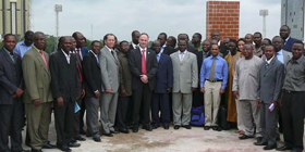
The mission included meetings with representatives of various government agencies including the Ministry of Environment and Forest Resource, the Department of Cadastre and Cartography, the Fire Department and with representatives of UN organizations in Togo (WHO, FAO, UNDP, OCHA etc.). The mission also included a two-day workshop with representatives from more than 30 governmental agencies and national institutions involved in disaster management activities.
The expert team found that:
- Recognizing the need to reduce the impacts of events such as floods, Togo is shifting efforts from emergency response to disaster-risk management (DRR). Such efforts include mainstreaming DRR activities in development plans, risk assessment, early warning and preparedness.
- The government of Togo is in the process of updating disaster management plan with the support of UNDP consultants.
- While several organizations are involved in disaster management, none of them use space-based information in their planning or implementation. The main reasons include the lack of awareness amongst decision makers about the usage of space based information in disaster management, the lack of opportunities to access space based information, the lack of technical expertise to make use of such information, and the lack of financial resources.
- In Togo several government institutions have the capacity to use GIS including the Department of Cartography and Cadastre (DCC), the Ministry of Environment and Forest Resources, the Water Commission and the University of Lome;
- In the context of remote sensing, both the DCC and the University of Lome have the capacities to process remote sensing data;
- There is a need to generate geo-spatial data to be used in disaster-risk management and emergency response efforts. Nevertheless, the mission took note of the fact that The Surveyor General is implementing a national spatial data infrastructure. The project called SIGIT will be hosted by the National Geographic Institute. When the project is completed, all available space-based data will be available in digital format and new data will be collected and thus update existing database;
- Currently no Government institution is in the position to activate the International Charter: Space and Major Disasters.
Given the efforts conducted by several institutions on DRR, a recommendation is made to these institutions to use space-based technology and information for disaster risk reduction in a systematic way, e.g. through risk mapping and vulnerability analysis;
Political actors need to be mobilised and get their support so that government agencies can implement the SIGIT project focusing on the spatial data infrastructure, and facilitate data development and capacity building on the use of space based information for disaster management and emergency response;
Government institutions should conduct an inventory of the existing spatial data (topographic maps, thematic maps, satellite imageries, aerial photographs, orthophotos and geodetic data) and identify the producers and users of spatial data;
Spatial data should be available at all levels of the cycle of disaster (prevention, mitigation, preparedness, response, rehabilitation) and this needs to be incorporated in the strategic plan;
UN-SPIDER, the International Charter and other mechanisms in place should provide spatial data with a minimum of processing requests: It is recommended that disaster management agencies/authorities keep record of the support offered by UN-SPIDER and establish mechanism to coordinate with UN-SPIDER in case of disasters;
The government agencies should facilitate institutional strengthening through the training of their staff on the use of GIS and remote sensing applications in the areas of disaster risk reduction and emergency response;
