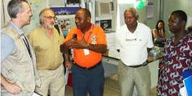
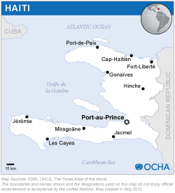
The mission was led by Mr Juan Carlos Villagran, UN-SPIDER. The mission benefited from the substantive support provided by the Office of the Special Representative of the Secretary General of the United Nations to Haiti (SRSG) and the United Nations Stabilization Mission in Haiti (MINUSTAH) GIS unit.
The mission included meetings with staff from the Civil Protection Agency and the National Center for Geo-Spatial Information (CNIGS), MINUSTAH, MINUSTAH-GIS, the United Nations Office for the Coordination of Humanitarian Affairs (UNOCHA), the United Nations Office for Disaster Risk Reduction (UNISDR), EU-Civil Protection, and various NGOs supporting recovery efforts in Haiti.
In addition, the mission included follow-up meetings in Washington with representatives of the Global Facility for Disaster Reduction and Recovery (GFDRR), the World Bank, and with government agencies of the United States (Department of State, US Agency for International Development, US Foreign Disaster Assistance (OFDA), NASA), as well as with representatives from Thermopylae Sciences and Technology, a consulting company providing support to US Southern Command.
- Due to the impacts of the disaster on many government agencies, including CPA and CNIGS, access to and use of space-based information is basically limited to international donor agencies, the World Bank and organizations from the United Nations active in Haiti;
- The headquarters of CNIGS and CPA were destroyed, as well as the EOC. Nevertheless, most of the digital data (nearly 90%) has been recovered. CNIGS was also able to recover aerial photos of the whole country;
- Space-based imagery is used to track the dynamics of refugee camps and to identify potential sites for temporary housing units. This work is being realized by an OCHA team that includes the support of NGOs such as MapAction and IMAAP;
- A variety of institutions outside Haiti, including the International Charter: Space and Major Disasters, UN-SPIDER's Regional Support Offices such as CATHALAC and Volunteer Technical Communities are generating space-based information to support response and recovery efforts;
- At the request of the United States Southern Command, the private company Thermopylae Sciences and Technology developed a geo-viewer called 3D-UDOP that is built on the bases of Google Earth and is being tested in Haiti;
- The MINUSTAH-GIS unit, located at the Log Base, did not suffer any damages. It has been set up by the Cartographic Section to support the standard operations of MINUSTAH and Armed Forces cooperating with the UN in Haiti and spans all the provinces of the country. As a result of the earthquake, the unit has provided support to United Nations agencies and NGOs in terms of the elaboration and plotting of large scale maps in various sizes;
- While MINUSTAH-GIS is aware of UN-SPIDER, it is not aware of the explicit uses of space-based information which was available on the Knowledge Portal;
- The World Bank and the Join Research Centre of the European Commission are conducting a damage assessment of infrastructure using a variety of sources including satellite imagery.
As CNIGS has trained staff which can analyze geo-spatial imagery, it needs to be involved in the process of generating geospatial-based information to support the decision-making process in the context of the recovery activities conducted in Haiti. CNIGS should also be linked into the US- and UN-led efforts on the generation and use of space-based information.
It would be desirable for UN-SPIDER to support both CNIGS and CPA in the establishment and use of geo-viewers, either in the version elaborated by ESRI and the other one elaborated by Thermopylae Science and Technology Company for the US Southern Command to support operations in Haiti. In particular during the coming hurricane season, where floods and landslides could also affect this country.
Coordination has to be ensured between the CPA and CNIGS, other government agencies on the one hand and MINUSTAH-GIS and UNOCHA on the other hand. Both MINUSTAH-GIS and UNOCHA have ample internet capacities and plotting facilities, which could provide the necessary support to CNIGS and to the CPA in case of upcoming natural disasters. To become an effective partner in the generation of information to be used in the recovery process, CPA will need support to rebuild its capacities in terms of infrastructure and in terms of training activities.


