A Recommended Practice elaborated by UN-SPIDER's Regional Support Office in Ukraine, was used by to create maps in a recent activation of the International Charter: Space and Major Disasters for the Plurinational State of Bolivia.
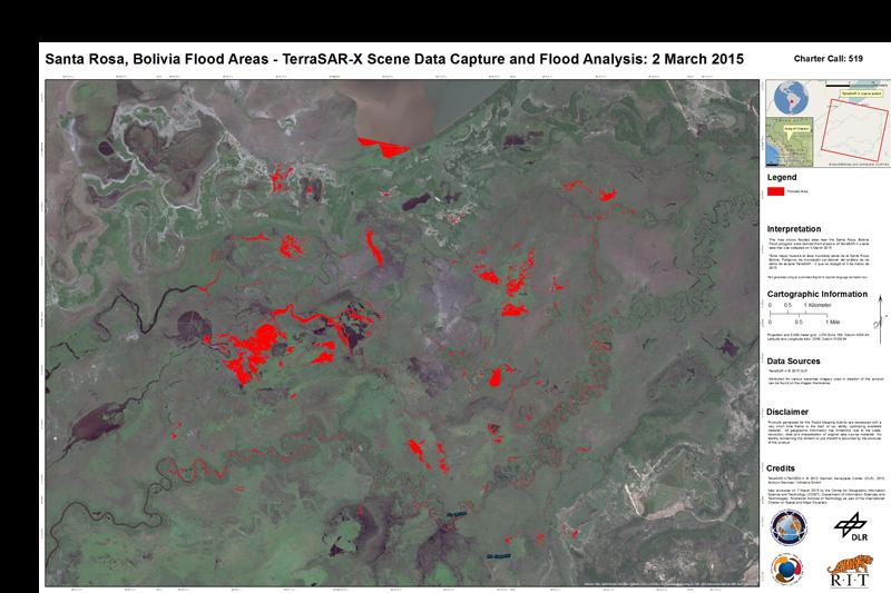
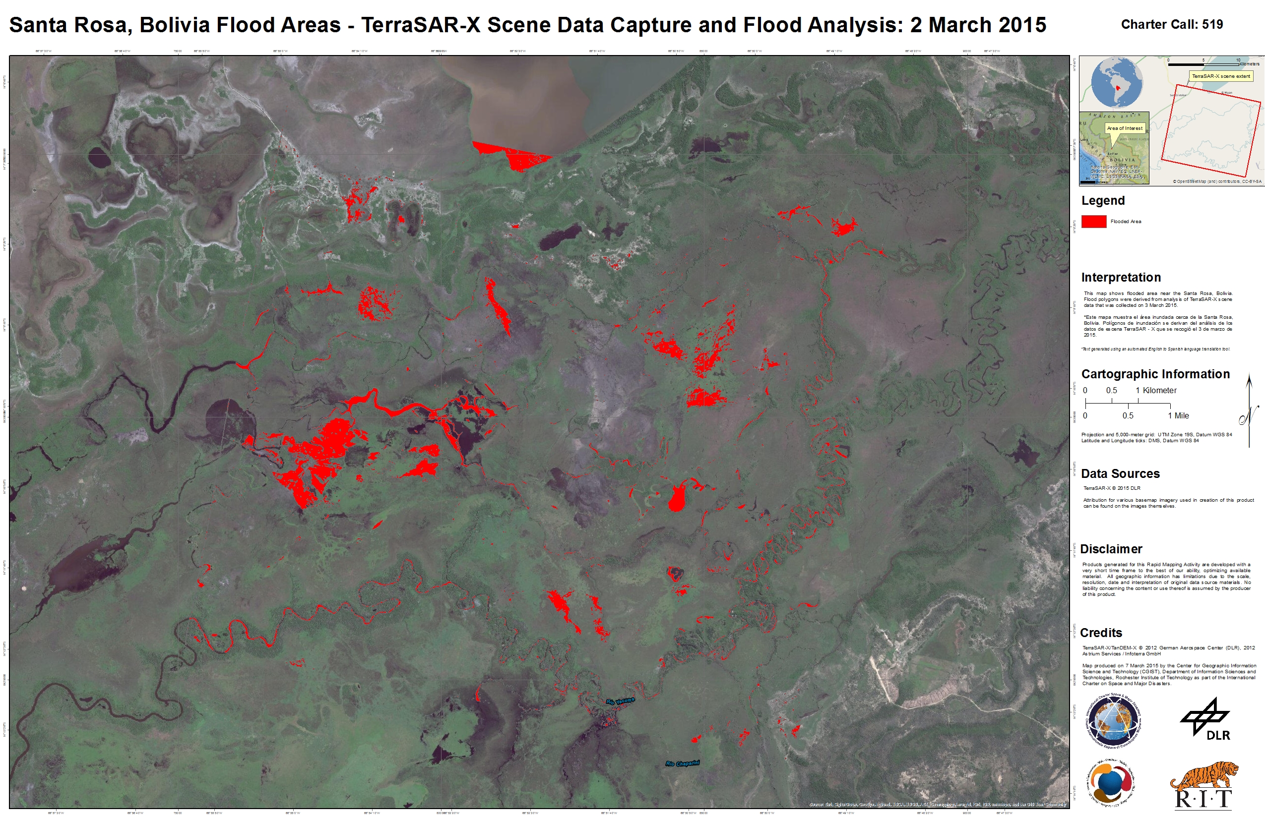
The mechanism was triggered on 25 February 2015 after heavy floods started affecting the northern part of the country. The flooding had been caused by accumulating rainfall since January, causing the River Acre to overflow.
The call for activation was issued by SIFEM-DNPC on behalf of SINAGER - VIDECI. The United States Geological Survey (USGS) was the project manager for the activation. The Rochester Institute of Technology was requested to create the maps based on satellite radar data obtained from the German Aerospace Center's Terra-SAR-X satellite. The expert applied the flood mapping procedure of the Recommended Practice: Flood Mapping by the Space Research Institute NASU-SSAU, Ukraine by following the method's step by step instructions.
NASU-SSAU is a Regional Support Office of UN-SPIDER. Together with its network of Regional Support Office, UN-SPIDER started the Recommended Practices project in order to provide users with step by step instructions to create specific satellite-based products. So far, three practices have been elaborated and published on UN-SPIDER's Knowledge Portal.
The maps generated for the Bolivia flood call are available for download on the International Charter's website.
| Attachment | Taille |
|---|---|
| Flood map of Santa Rosa, Bolivia, 3 March 2015 | 2.76 MB |