• English
  • Español
  • Français

United
Nations


Office for Outer Space Affairs
UN-SPIDER Knowledge Portal

  • Accueil
  • À propos
    • Qu'est-ce que l'ONU-SPIDER?
    • À propos d’UNOOSA
    • Publications
    • Offres d'emploi
    • Rencontrez l'équipe
    • Contact
  • Applications spatiales
    • Technologie satellitaire
    • Mécanismes d’urgence
    • Recovery Mechanisms
    • Réseau international d'alerte aux astéroïdes
    • Space Mission Planning Advisory Group
    • Initiative internationale sur la météorologie spatiale
    • Les technologies spatiales à l'ONU
    • Comptes-rendus d'utilisateurs
  • Liens & ressources
    • Application de données du mois
      • Disaster Recovery
    • Sources de données
    • SIG et logiciels de télédétection
    • Online Learning Resources
    • Institutions
  • Risques & catastrophes
    • Prévention des risques de catastrophe
    • Systèmes d'alerte précoce
    • Gestion des catastrophes et des interventions d'urgence
    • Aléas naturels
    • Cadre d'action de Sendai
    • L'ONU et la prévention des risques de catastrophe
    • L'ONU et les alertes précoces
    • L'ONU et la gestion des catastrophes
  • Appui technique
    • Missions Conseil
    • Appui d’urgence
    • Appui à distance
    • Pratiques recommandées
    • Activités de formation
    • Utilisations pratiques
  • Réseaux
    • Bureaux régionaux d’appui
    • GP-STAR
    • MHEWS
    • IWG-SEM
  • Projets
    • SPEAR
    • SEWS-D
    • EvIDENz
    • Flood GUIDE
  • Actualités
    • Actualités
    • Événements
    • Événements passés

Breadcrumb

  • Home
  • Fiji Minister Urges Industry To Embrace Geospatial Technology
  • Fiji minister urges industry to embrace geospatial technology

Fiji minister urges industry to embrace geospatial technology

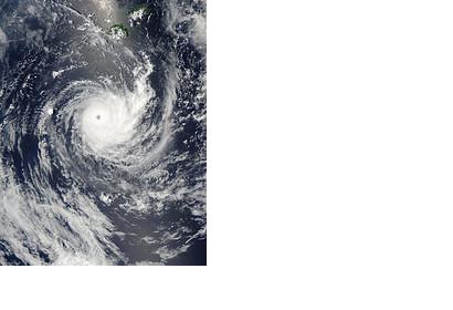
Tropical Cyclone Wilma raged over the Pacific OceanTropical cyclone Wilma off Fiji (Image: NASA)

Fiji's Minister for Lands, Mere Vuniwaqa, stressed the importance of using geospatial technology in urban and regional planning, as well as climate change and green growth, as the Fiji Broadcasting Corporation reported.

Vuniwaqa commented on the potential uses space-based technology could have in the management and strategic decision making in various areas that are relevant for development. According to her, geospatial technology could be of great usefulness for sectors such as agriculture, disaster management, land management, public utility management, town and regional planning and tax collection as well as elections.

The declarations were made during the first high level Geospatial Information Management Conference. The conference aimed at propagate and promote the use of geospatial technology in the developmental projects of the country.
Fiji Broadcasting Corporation
Thu, 20 Nov 2014 - 09:18
Fiji

Footer menu

  • Contact
  • Terms of Use

User account menu

  • Log in