  • English
  • Español
  • Français

United
Nations


Office for Outer Space Affairs
UN-SPIDER Knowledge Portal

  • Accueil
  • À propos
    • Qu'est-ce que l'ONU-SPIDER?
    • À propos d’UNOOSA
    • Publications
    • Offres d'emploi
    • Rencontrez l'équipe
    • Contact
  • Applications spatiales
    • Technologie satellitaire
    • Mécanismes d’urgence
    • Recovery Mechanisms
    • Réseau international d'alerte aux astéroïdes
    • Space Mission Planning Advisory Group
    • Initiative internationale sur la météorologie spatiale
    • Les technologies spatiales à l'ONU
    • Comptes-rendus d'utilisateurs
  • Liens & ressources
    • Application de données du mois
      • Disaster Recovery
    • Sources de données
    • SIG et logiciels de télédétection
    • Online Learning Resources
    • Institutions
  • Risques & catastrophes
    • Prévention des risques de catastrophe
    • Systèmes d'alerte précoce
    • Gestion des catastrophes et des interventions d'urgence
    • Aléas naturels
    • Cadre d'action de Sendai
    • L'ONU et la prévention des risques de catastrophe
    • L'ONU et les alertes précoces
    • L'ONU et la gestion des catastrophes
  • Appui technique
    • Missions Conseil
    • Appui d’urgence
    • Appui à distance
    • Pratiques recommandées
    • Activités de formation
    • Utilisations pratiques
  • Réseaux
    • Bureaux régionaux d’appui
    • GP-STAR
    • MHEWS
    • IWG-SEM
  • Projets
    • SPEAR
    • SEWS-D
    • EvIDENz
    • Flood GUIDE
  • Actualités
    • Actualités
    • Événements
    • Événements passés
  • Admin
    • SAM Items

Breadcrumb

  • Home
  • UK-DMC-2
  • UK-DMC-2

UK-DMC-2

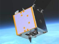
UK-DMC2 is based on the SSTL-100 satellite platform and was launched in 2009 for the commercial imaging company, DMCii (a subsidiary of SSTL). It provides high resolution (22m) imagery from a sun-synchronous orbit over very large areas (650km swath, 2000km along track), with a daily revisit to global targets.
The UK-DMC2 satellite carries a multispectral optical instrument with a spatial resolution of 22 m with three spectral bands (red, green, NIR) and a wide swath of more than 600 km. UK-DMC2 operates within the Disaster Monitoring Constellation, the first Earth observation constellation of low cost small satellites providing daily images for applications including global disaster monitoring. The Disaster Monitoring Constellation is coordinated by DMC International Imaging Ltd (DMCii) for disaster response within the International Charter: Space & Major Disasters.

Instrument: SLIM6-22
- compact imager with 22m GSD at 686km orbital height
- nadir pointing at all times in standard imaging mode
- 2 banks of 3 spectral bands each (Red, Green, Near Infrared)
- Pushbroom type
- 650km swath

29 Jul 2009
5years
Sun synchronous
98 minutes
DMCii
UKSA
Wide area, medium resolution optical imaging for mapping, crop monitoring, environmental resource and disaster management
Sécheresse
Éclatement du lac glaciaire
Efflorescences algales nuisibles
Glissement de terrain
Tremblement de terre
Inondation
Feu de forêt
Mouvement de masse
Tsunami
Éruption volcanique
No
Information about UK-DMC-2

Footer menu

  • Contact
  • Terms of Use

User account menu

  • Log in