• English
  • Español
  • Français

United
Nations


Office for Outer Space Affairs
UN-SPIDER Knowledge Portal

  • Accueil
  • À propos
    • Qu'est-ce que l'ONU-SPIDER?
    • À propos d’UNOOSA
    • Publications
    • Offres d'emploi
    • Rencontrez l'équipe
    • Contact
  • Applications spatiales
    • Technologie satellitaire
    • Mécanismes d’urgence
    • Recovery Mechanisms
    • Réseau international d'alerte aux astéroïdes
    • Space Mission Planning Advisory Group
    • Initiative internationale sur la météorologie spatiale
    • Les technologies spatiales à l'ONU
    • Comptes-rendus d'utilisateurs
  • Liens & ressources
    • Application de données du mois
      • Disaster Recovery
    • Sources de données
    • SIG et logiciels de télédétection
    • Online Learning Resources
    • Institutions
  • Risques & catastrophes
    • Prévention des risques de catastrophe
    • Systèmes d'alerte précoce
    • Gestion des catastrophes et des interventions d'urgence
    • Aléas naturels
    • Cadre d'action de Sendai
    • L'ONU et la prévention des risques de catastrophe
    • L'ONU et les alertes précoces
    • L'ONU et la gestion des catastrophes
  • Appui technique
    • Missions Conseil
    • Appui d’urgence
    • Appui à distance
    • Pratiques recommandées
    • Activités de formation
    • Utilisations pratiques
  • Réseaux
    • Bureaux régionaux d’appui
    • GP-STAR
    • MHEWS
    • IWG-SEM
  • Projets
    • SPEAR
    • SEWS-D
    • EvIDENz
    • Flood GUIDE
  • Actualités
    • Actualités
    • Événements
    • Événements passés

Breadcrumb

  • Home
  • Africa Geospatial Forum Postponed Due To Ebola Outbreak
  • Africa Geospatial Forum postponed due to Ebola outbreak

Africa Geospatial Forum postponed due to Ebola outbreak

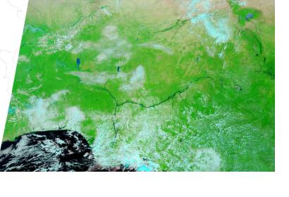
Nigeria seen from spaceNigeria seen from space

The Africa Geospatial Forum, scheduled to take place in Lagos, Nigeria on 19 and 20 August 2014, had to be postponed due to the Ebola outbreak in the region, as the organizers announced: "Considering the wellbeing of our participants, exhibitors and sponsors, Geospatial Media and Communications and Lagos State Government are re-scheduling Africa Geospatial Forum to 9 - 10 December, 2014 at the same venue, when organising such a gathering will yield maximum benefits for all stakeholders involved."

Since it first took place in 2006, the Africa Geospatial Forum (formerly known as Map Africa) has played a significant role in bringing together the geospatial community of Africa. Its participants discuss key issues such as the current usage of geospatial technologies across the continent, technology trends and the future of the geospatial industry in the region in order to ensure the further growth and usage of the technology.

The 2014 theme of the Forum is "Smart Governance: Connecting Geospatial Community"
Geospatial World
Mon, 18 Aug 2014 - 07:44
Nigeria

Footer menu

  • Contact
  • Terms of Use

User account menu

  • Log in