![]()
United
Nations
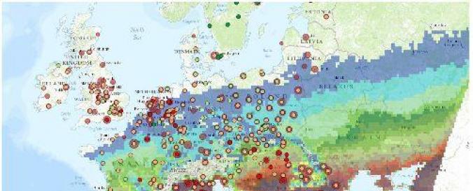
Extreme Heat Risk Map (EEA)
| Data provided by: | The European Environment Agency (EEA) |
| Data accessibility: | visualization of data (e.g. web GIS or real time monitoring) |
| Data type: | hazard specific data |
| Hazard: | Drought, Extreme Temperature |
| Disaster cycle phase: | Disaster Risk Management |
| Space-based Information: | Ground-Based Information |
| Spatial coverage: | Europe |
| Spatial resolution: | 18000.00 |
| Temporal coverage: | Archive, Forecasted |
| Content dates: | 1971-2100 |
| Technical Specifications: | |
| Costs: | free |
| Contact: | Look for "Contact Esri" link |
| Tutorials on the use of data: | Help |
| Restrictions/ Citation of the dataset: |
Provider
![]()