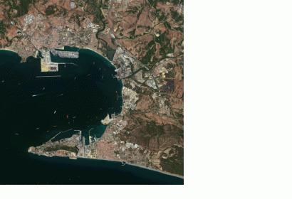
Astrium Services has posted the first images from the SPOT 6 satellite. SPOT 6 will assure continuity of data from the series of satellites operating since 1986, along with many technological innovations. Its unique responsiveness and acquisition capacity are set to benefit a broad spectrum of operational applications. These first images present very varied landscapes, highlighting SPOT 6’s potential for applications like urban and natural resource mapping or agricultural and environmental monitoring. The wide imaging swath (60km), identical to that of the other SPOT satellites, enables SPOT 6 to cover vast territories, while its 1.5m resolution – against 2.5m on SPOT 5 – enables it to distinguish very small features. To post the images, all operational systems swung smoothly into action, from satellite tasking to image acquisition, reception and processing.
SPOT 6 had been placed in orbit by an Indian PSLV rocket from the Sriharikota launch base on 9 September 2012.

