  • English
  • Español
  • Français

United
Nations


Office for Outer Space Affairs
UN-SPIDER Knowledge Portal

  • Accueil
  • À propos
    • Qu'est-ce que l'ONU-SPIDER?
    • À propos d’UNOOSA
    • Publications
    • Offres d'emploi
    • Rencontrez l'équipe
    • Contact
  • Applications spatiales
    • Technologie satellitaire
    • Mécanismes d’urgence
    • Recovery Mechanisms
    • Réseau international d'alerte aux astéroïdes
    • Space Mission Planning Advisory Group
    • Initiative internationale sur la météorologie spatiale
    • Les technologies spatiales à l'ONU
    • Comptes-rendus d'utilisateurs
  • Liens & ressources
    • Application de données du mois
      • Disaster Recovery
    • Sources de données
    • SIG et logiciels de télédétection
    • Online Learning Resources
    • Institutions
  • Risques & catastrophes
    • Prévention des risques de catastrophe
    • Systèmes d'alerte précoce
    • Gestion des catastrophes et des interventions d'urgence
    • Aléas naturels
    • Cadre d'action de Sendai
    • L'ONU et la prévention des risques de catastrophe
    • L'ONU et les alertes précoces
    • L'ONU et la gestion des catastrophes
  • Appui technique
    • Missions Conseil
    • Appui d’urgence
    • Appui à distance
    • Pratiques recommandées
    • Activités de formation
    • Utilisations pratiques
  • Réseaux
    • Bureaux régionaux d’appui
    • GP-STAR
    • MHEWS
    • IWG-SEM
  • Projets
    • SPEAR
    • SEWS-D
    • EvIDENz
    • Flood GUIDE
  • Actualités
    • Actualités
    • Événements
    • Événements passés

Breadcrumb

  • Home
  • First Images From ESA’s Water Mission
  • First images from ESA’s water mission

First images from ESA’s water mission

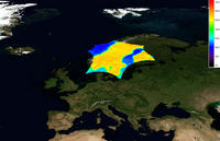
In less than four months since launch, the first calibrated images are being delivered by ESA’s SMOS mission. These images of 'brightness temperature' translate into clear information on global variations of soil moisture and ocean salinity to advance our understanding of the water cycle.

Launched on 2 November, the Soil Moisture and Ocean Salinity (SMOS) mission is improving our understanding of Earth’s water cycle by making global observations of soil moisture over land and salinity over oceans. By consistently mapping these two variables, SMOS will not only advance our understanding of the exchange processes between Earth’s surface and atmosphere, but will also help to improve weather and climate models.
In addition, the data from SMOS will have several other applications in areas such as agriculture and water resource management.

Source: European Space Agency

For the full article please visit: http://www.esa.int/esaCP/SEMOGN3KV5G_index_1.html

Fri, 26 Feb 2010 - 09:23

Footer menu

  • Contact
  • Terms of Use

User account menu

  • Log in