
Overview of the Disaster and Objectives
Hurricane Melissa made landfall in Jamaica on 28 October 2025 as a Category 5 storm, bringing extreme rainfall, destructive winds, and severe storm surge that triggered widespread flooding and landslides across the island. According to the U.S. Geological Survey, Melissa’s torrential rain destabilized saturated hillsides and amplified the likelihood of landslide activity across vulnerable mountainous terrain, while low-lying coastal regions experienced substantial flood inundation driven by a combination of rainfall accumulation and coastal surge. The documented impacts included destroyed infrastructure, extensive residential losses, transportation disruption, and severe damage to critical lifelines. Preliminary national-level estimations indicate that the economic cost of the disaster may reach an unprecedented level, affecting housing, public facilities, agriculture, and key economic sectors.
Source: USGS, 2025 Hurricane Melissa Landslide Hazards, https://www.usgs.gov/programs/landslide-hazards/science/2025-hurricane-melissa-landslide-hazards
Background and Context
Jamaica is characterized by steep mountainous terrain combined with densely populated low-lying coastal plains, producing structural vulnerability to both landslides and flooding during high-intensity tropical cyclones. Rapid intensification processes associated with Hurricane Melissa produced historically severe rainfall totals, creating widespread overflow of river basins and the rapid inundation of residential areas, agricultural land, and transportation corridors. The simultaneous occurrence of storm surge along the southern coastline and basin flooding significantly increased the extent of the affected region and prolonged water retention in flat coastal zones.
Satellite-based Flood Analysis and Methodology
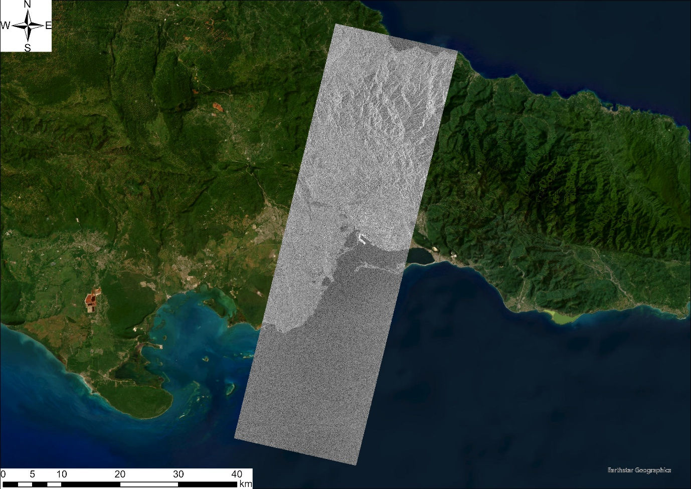
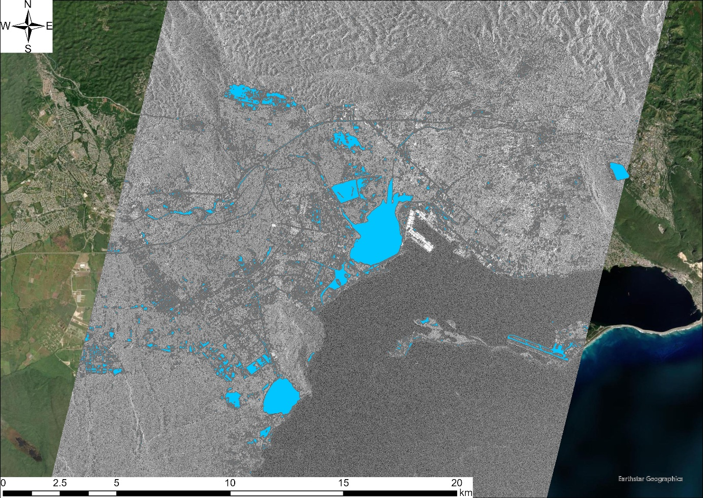
To support rapid response operations, flood extent was mapped using Synthetic Aperture Radar (SAR) satellite imagery acquired by Synspective’s StriX constellation over the southern region of Jamaica shortly after landfall. SAR technology enables observation independent of cloud cover and sunlight, allowing timely detection of inundated zones during ongoing rainfall conditions and immediately after the disaster. The SAR amplitude change analysis allowed clear delineation between open water bodies, flooded surfaces, and unaffected areas, providing a precise view of floodwater distribution during the peak impact period.
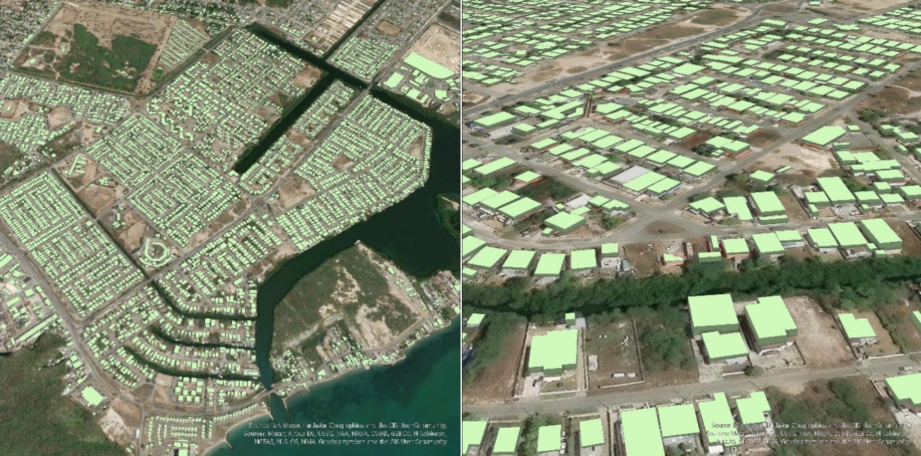
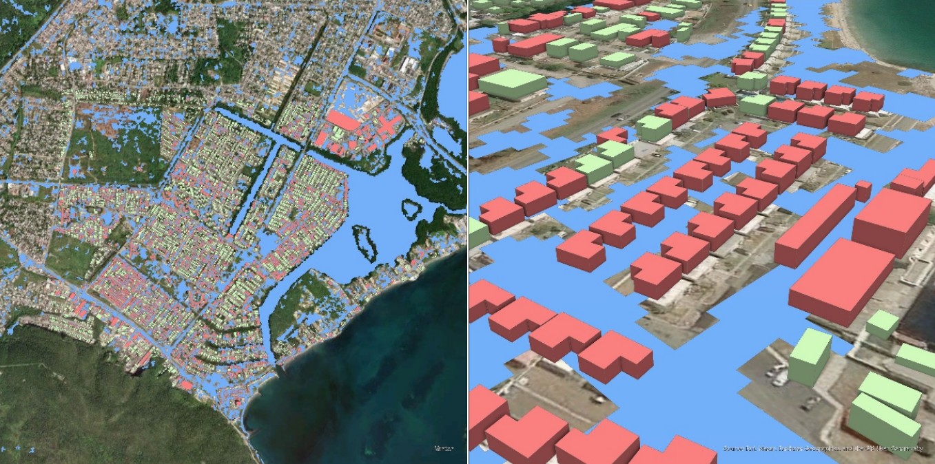
To complement the SAR-based flood detection, a three-dimensional analysis was performed using high-resolution elevation models and Copernicus 30-meter digital elevation data to estimate potential floodwater depth. The elevation-derived hydraulic modeling enabled the estimation of vertical water accumulation across various parts of the impacted region and facilitated assessment of the relative flood severity at the scale of individual residential structures. Building footprints and urban topography were incorporated into the modelling framework to classify inundation levels by structure, indicating areas likely affected by floor-level or above-floor-level floodwater. This type of analysis is critical for prioritizing humanitarian relief, planning safe access routes, and designing targeted reconstruction strategies.
Results
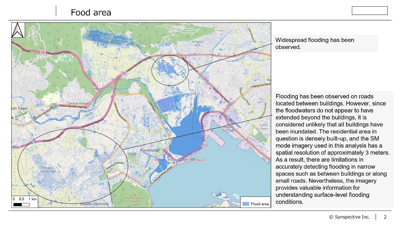
The combined SAR and 3D modeling revealed extensive flooding across low-lying coastal communities near the southern shoreline and around the floodplains adjacent to major river systems. The estimated inundation depth ranged from several tens of centimeters to potentially multiple meters in some basin areas, particularly in zones where runoff volume converged with storm-surge pressure. The analysis indicated that residential clusters situated in coastal plains and river delta zones faced the highest levels of structural flood exposure, with a notable concentration of deeply inundated structures. These findings were visually confirmed through SAR imagery, which highlighted water-covered land surfaces consistent with the predicted inundation zones derived from the 3D depth analysis.
Implications for Response, Recovery, and Resilience
The flood-mapping analysis illustrates the relevance of integrating space-based observation and 3D modeling within emergency operations. Satellite analysis provides rapid situational awareness even when access to the ground is restricted, reducing delays in relief deployment. The depth-based structural prioritization framework supports targeted resource allocation and allows responders to identify the most heavily affected households more efficiently. The findings emphasize the need for resilient land-use planning, elevation-based zoning, and reinforced coastal protection strategies. They further demonstrate the necessity of investment in real-time monitoring systems such as rain-gauge networks, high-resolution early warning systems, and frequent space-based observations.
The combined approach adopted in this assessment highlights the central role of remote-sensing technologies in disaster response and strengthens the case for long-term integration of Earth observation into national emergency management systems. Continued collaboration with international satellite operators, academic research centers, and local institutions will enable ongoing improvement of flood-risk modeling, preparedness, and climate resilience planning.