  • English
  • Español
  • Français

United
Nations


Office for Outer Space Affairs
UN-SPIDER Knowledge Portal

  • Accueil
  • À propos
    • Qu'est-ce que l'ONU-SPIDER?
    • À propos d’UNOOSA
    • Publications
    • Offres d'emploi
    • Rencontrez l'équipe
    • Contact
  • Applications spatiales
    • Technologie satellitaire
    • Mécanismes d’urgence
    • Recovery Mechanisms
    • Réseau international d'alerte aux astéroïdes
    • Space Mission Planning Advisory Group
    • Initiative internationale sur la météorologie spatiale
    • Les technologies spatiales à l'ONU
    • Comptes-rendus d'utilisateurs
  • Liens & ressources
    • Application de données du mois
      • Disaster Recovery
    • Sources de données
    • SIG et logiciels de télédétection
    • Online Learning Resources
    • Institutions
  • Risques & catastrophes
    • Prévention des risques de catastrophe
    • Systèmes d'alerte précoce
    • Gestion des catastrophes et des interventions d'urgence
    • Aléas naturels
    • Cadre d'action de Sendai
    • L'ONU et la prévention des risques de catastrophe
    • L'ONU et les alertes précoces
    • L'ONU et la gestion des catastrophes
  • Appui technique
    • Missions Conseil
    • Appui d’urgence
    • Appui à distance
    • Pratiques recommandées
    • Activités de formation
    • Utilisations pratiques
  • Réseaux
    • Bureaux régionaux d’appui
    • GP-STAR
    • MHEWS
    • IWG-SEM
  • Projets
    • SPEAR
    • SEWS-D
    • EvIDENz
    • Flood GUIDE
  • Actualités
    • Actualités
    • Événements
    • Événements passés

Breadcrumb

  • Home
  • 8th International Conference On Cartography & GIS (ICCGIS)
  • 8th International Conference on Cartography & GIS (ICCGIS)

8th International Conference on Cartography & GIS (ICCGIS)

International Corographic Association (ICA), Bulgarian Carographic Association, University of Architecture, Civil Engineering and Geodesy

Mon, 15 Jun - Sat, 20 Jun 2020
Sun 31 May 2020
ICCGIS2020

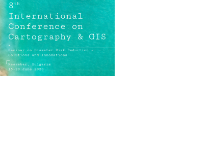
The aim of the conference is to collect knowledge and share experience about the latest achievements in the field of cartography and GIS. Multiple parallel events take place during the conference, including annual meetings of ICA commissions, exhibition of maps and other cartographic products, demonstrations of software and hardware products.


Topics include: 

  • User Needs and Context Mapping for Early Warning and Crisis Management
  • Visualization of Geodata for Early Warning and Crisis Management
  • Volunteered Geographic Information
  • Web Cartography and Digital Atlases
Center of Culture and Education
Nessebar
Bulgaria
English
academic

Footer menu

  • Contact
  • Terms of Use

User account menu

  • Log in