  • English
  • Español
  • Français

United
Nations


Office for Outer Space Affairs
UN-SPIDER Knowledge Portal

  • Accueil
  • À propos
    • Qu'est-ce que l'ONU-SPIDER?
    • À propos d’UNOOSA
    • Publications
    • Offres d'emploi
    • Rencontrez l'équipe
    • Contact
  • Applications spatiales
    • Technologie satellitaire
    • Mécanismes d’urgence
    • Recovery Mechanisms
    • Réseau international d'alerte aux astéroïdes
    • Space Mission Planning Advisory Group
    • Initiative internationale sur la météorologie spatiale
    • Les technologies spatiales à l'ONU
    • Comptes-rendus d'utilisateurs
  • Liens & ressources
    • Application de données du mois
      • Disaster Recovery
    • Sources de données
    • SIG et logiciels de télédétection
    • Online Learning Resources
    • Institutions
  • Risques & catastrophes
    • Prévention des risques de catastrophe
    • Systèmes d'alerte précoce
    • Gestion des catastrophes et des interventions d'urgence
    • Aléas naturels
    • Cadre d'action de Sendai
    • L'ONU et la prévention des risques de catastrophe
    • L'ONU et les alertes précoces
    • L'ONU et la gestion des catastrophes
  • Appui technique
    • Missions Conseil
    • Appui d’urgence
    • Appui à distance
    • Pratiques recommandées
    • Activités de formation
    • Utilisations pratiques
  • Réseaux
    • Bureaux régionaux d’appui
    • GP-STAR
    • MHEWS
    • IWG-SEM
  • Projets
    • SPEAR
    • SEWS-D
    • EvIDENz
    • Flood GUIDE
  • Actualités
    • Actualités
    • Événements
    • Événements passés
  • Admin
    • SAM Items

Breadcrumb

  • Home
  • KOMPSAT-3 / Arirang-3
  • KOMPSAT-3 / Arirang-3

KOMPSAT-3 / Arirang-3

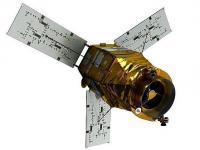
KOMPSAT-3 is an optical high-resolution Korean observation mission of KARI (Korea Aerospace Research Institute). The mission is funded by MEST (Ministry of Education, Science and Technology). The project was started in 2004. The objective is to provide observation continuity from the KOMPSAT-1 and KOMPSAT-2 missions to meet the nation's needs for high-resolution optical imagery required for GIS (Geographical Information Systems) and other environmental, agricultural and oceanographic monitoring applications.

A further goal is to meet the nation's satellite demand and form a technology infrastructure that will make inroads into the world space industry at a stage when the industry is improving the capability to design and develop highly advanced remote sensing satellites.

Instrument: AEISS (Advanced Electronic Image Scanning System)
- 5 spectral bands (Panchromatic, blue, green, red, NIR)
- swath width: 16km (at nadir)

18 May 2012
4years
Sun synchronous
99 minutes
KARI
ASTRIUM
Cartography, land use and planning, disaster monitoring
Sécheresse
Éclatement du lac glaciaire
Glissement de terrain
Tremblement de terre
Inondation
Feu de forêt
Mouvement de masse
Tsunami
Éruption volcanique
No
Information about KOMPSAT-3 on KARI web page

Footer menu

  • Contact
  • Terms of Use

User account menu

  • Log in