![]()
United
Nations
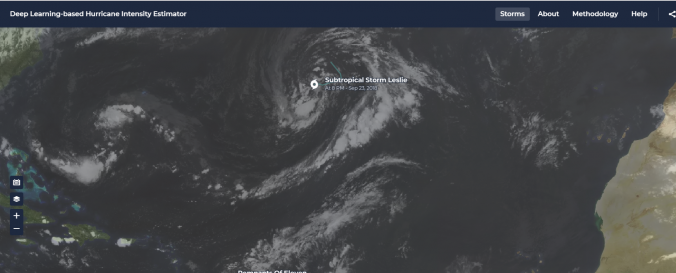
Deep Learning-based Hurricane Intensity Estimator (NASA)
| Data provided by: | National Aeronautics and Space Administration (NASA) |
| Data accessibility: | statistical data (e.g. graphs), visualization of data (e.g. web GIS or real time monitoring) |
| Link to the data: | |
| Data type: | hazard specific data, satellite data or aerial image |
| Hazard: | Severe Storm |
| Disaster cycle phase: | Disaster Risk Management, Response, Recovery |
| Satellites and Sensors: | GOES- 8-15 (IMAGER) |
| Spatial coverage: | Global |
| Spatial resolution: | 0.5 - 2 km |
| Temporal coverage: | Near-real time |
| Technical Specifications: | |
| Costs: | free |
| Contact: | Feedback Platform |
Provider
![]()