Through the use of satellite data, two projects in Malaysia, Ethiopia and Kenya aim to generate new information for key decision makers. The objective of the projects is to intervene as early as possible to protect people and the environment.
In Malaysia a project consortium together with the National Defence University of Malaysia (NDUM) and the University of Oxford will cooperate with local government agencies to combat flooding, oil pollution and illegal logging. The project wants to make it possible for evacuation plans and flood defences to be activated much faster with the help of satellite data. Additionally, it will generate satellite data that will support the authorities to swiftly recognize and track oil leaks from ships which are causing irreparable damage to Malaysia's environment, and to pinpoint areas where illegal logging is taking place.
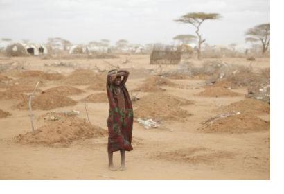
In Ethiopia and Kenya the main focus of the project devised by a consortium together with the Ethiopian Development Research Institute (EDRI) and the University of Oxford will be on a better understanding of flood and drought risk through satellite data, ultimately to help build local people's resilience to these natural disasters. The intention is to make use of the same data to provide an emergency response when needed and to come up with long-run strategies and solutions to drought and flood.
More than £21 million will be invested in the two projects, with over £10 million being contributed by the UK Space Agency. Both projects are contributing to several of the Sustainable Development Goals, for example the conservation and sustainable use of the oceans and marine resources for sustainable development.

