• English
  • Español
  • Français

United
Nations


Office for Outer Space Affairs
UN-SPIDER Knowledge Portal

  • Accueil
  • À propos
    • Qu'est-ce que l'ONU-SPIDER?
    • À propos d’UNOOSA
    • Publications
    • Offres d'emploi
    • Rencontrez l'équipe
    • Contact
  • Applications spatiales
    • Technologie satellitaire
    • Mécanismes d’urgence
    • Recovery Mechanisms
    • Réseau international d'alerte aux astéroïdes
    • Space Mission Planning Advisory Group
    • Initiative internationale sur la météorologie spatiale
    • Les technologies spatiales à l'ONU
    • Comptes-rendus d'utilisateurs
  • Liens & ressources
    • Application de données du mois
      • Disaster Recovery
    • Sources de données
    • SIG et logiciels de télédétection
    • Online Learning Resources
    • Institutions
  • Risques & catastrophes
    • Prévention des risques de catastrophe
    • Systèmes d'alerte précoce
    • Gestion des catastrophes et des interventions d'urgence
    • Aléas naturels
    • Cadre d'action de Sendai
    • L'ONU et la prévention des risques de catastrophe
    • L'ONU et les alertes précoces
    • L'ONU et la gestion des catastrophes
  • Appui technique
    • Missions Conseil
    • Appui d’urgence
    • Appui à distance
    • Pratiques recommandées
    • Activités de formation
    • Utilisations pratiques
  • Réseaux
    • Bureaux régionaux d’appui
    • GP-STAR
    • MHEWS
    • IWG-SEM
  • Projets
    • SPEAR
    • SEWS-D
    • EvIDENz
    • Flood GUIDE
  • Actualités
    • Actualités
    • Événements
    • Événements passés

Breadcrumb

  • Home
  • Taxonomy Pages
  • Taxonomy Pages

South America

country taxonomy block

ESA launches biomass satellite to track forest carbon
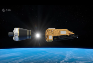
BIomass separates from Vega-C, (c) esa

The European Space Agency (ESA) successfully launched its flagship Biomass satellite on 29 April 2025 at 06:15 local time (11:15 CEST) from Europe’s Spaceport in Kourou, French Guiana, aboard a Vega-C rocket. Developed by Airbus Defence and Space, the satellite separated from the launch vehicle under an hour after liftoff. Shortly thereafter, ESA's operations center in Germany received the first signal from Biomass, transmitted via a ground station in Antarctica, confirming its healthy status in orbit.

Biomass marks a major milestone in ESA’s Earth Explorer program and is set to operate for at least five years. Equipped with the first-ever spaceborne P-band synthetic aperture radar, the mission will deliver highly detailed, global-scale maps of forest biomass by penetrating forest canopies to assess woody structures—trunks, branches, and stems—where the majority of carbon is stored. With a wavelength of about 70 cm, the radar can capture detailed interferometric images, even…

more
Publishing date 06/05/2025
SERVIR programme in Kenya provides EO data to help financial aid reach farmers more efficiently
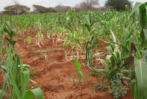
Crops in Kenya. Image: RCMRD.

A variety of environmental and man-made factors can have a detrimental effect on the yield of farmers worldwide. A programme launched in Kenya, funded by SERVIR in collaboration with NASA Harvest and the Swiss Re Foundation, uses Earth observation (EO) data to assess crop damage and prioritise the mobilisation of financial aid to farmers.

SERVIR is a joint initiative by the U.S. Agency for International Development (USAID) and NASA’s Earth Applied Sciences Program that works with “leading regional organizations world-wide to help developing countries use information provided by Earth observing satellites and geospatial technologies for managing…

more
Publishing date 03/03/2021
Regional Support Offices mentioned:
Regional Center for Mapping of Resources for Development (RCMRD)
Brazil Regional Support Office
Oficina Regional de Apoyo Brasil
Bureau Régional d'Appui du Brésil

Footer menu

  • Contact
  • Terms of Use

User account menu

  • Log in