• English
  • Español
  • Français

United
Nations


Office for Outer Space Affairs
UN-SPIDER Knowledge Portal

  • Inicio
  • Sobre nosotros
    • Sobre ONU-SPIDER
    • Acerca de UNOOSA
    • Publicaciones
    • Ofertas de trabajo
    • Conozca el Equipo
    • Contacto
  • Aplicación Espacial
    • Guías Tecnológicas
    • Mecanismos de Emergencia
    • Mecanismos de Recuperación
    • Red Internacional de Alerta de Asteroides
    • Grupo Asesor para la Planificación de Misiones Espaciales
    • Iniciativa Internacional sobre Meteorología Espacial
    • Tecnologías Espaciales en la ONU
    • Historias de Usuarios
  • Enlaces y Recursos
    • Aplicación de datos del mes
      • Disaster Recovery
    • Fuentes de Datos
    • SIG y Software de Percepción Remota
    • Recursos de capacitación en línea
    • Instituciones
  • Riesgos y Desastres
    • Gestión del Riesgo de Desastres
    • Alerta temprana
    • Gestión de Desastres y Emergencias
    • Amenazas Naturales
    • El Proceso de la Reducción de Desastres Post-2015
    • La ONU y la Gestión del Riesgo de Desastres
    • La ONU y Alerta Temprana
    • La ONU y la Gestión de Desastres
  • Asesoría
    • Misiones de Asesoría
    • Apoyo en caso de Emergencia
    • Asesoría Virtual
    • Prácticas Recomendadas
    • Actividades de Entrenamiento
    • Usos Prácticos
  • Redes
    • Oficinas Regionales de Apoyo
    • GP-STAR
    • IN-MHEWS
    • IWG-SEM
  • Proyectos
    • SPEAR
    • FOSAT-S
    • EvIDENz
    • Flood GUIDE
  • Noticias y Eventos
    • Noticias
    • Eventos
    • Eventos pasados

Breadcrumb

  • Home
  • Geospatial Data And Natural Disasters Included In The MDGs Report 2015
  • Geospatial data and natural disasters included in the MDGs Report 2015

Geospatial data and natural disasters included in the MDGs Report 2015

The last MDGs Report 2015 promotes the use of geospatial data (Image: NASA)The last MDGs Report 2015 promotes the use of geospatial data (Image: NASA)

The Millennium Development Goals (MDGs) Report 2015 was released yesterday, 6 June. The results presented serve as the basis for the upcoming sustainable development agenda that will be adopted this year.

Geospatial information and natural disasters have found their place among the lines of the report. Location-based information is mentioned as a tool to help governments and stakeholders improving their decision-making process and setting priorities. The access to geospatial data helps dealing with social, economic and environmental challenges such as health care during virus outbreaks or global climate changes, from sea level rise to unexpected natural disasters.

“Geospatial data can support monitoring in many aspects of development, from health care to natural resource management,” can be read within the report to highlight the need of access to better data for the post-2015 development agenda.

As an example, the new Millennium Development Goals (MDGs) Report 2015 presents the case of the chikungunya virus outbreak across the Caribbean, during which geospatial applications for smartphones assisted the Ministry of Health of Trinidad and Tobago to locate infected persons and use the information to contain the outbreak.

Extreme weather events and natural disasters are also taken into account as influent factors for humanitarian crises, strongly limiting the improvement of food security and the reduction of poverty and hunger, among others. 
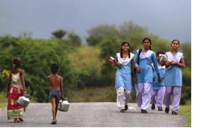
The Millennium Development Goals Report 2015
Tue, 7 Jul 2015 - 14:26
Global

Footer menu

  • Contact
  • Terms of Use

User account menu

  • Log in