The team met with about 15 key stakeholder agencies in the country including the Survey Department, the Meteorological Service or the National Remote Sensing Centre. The experts took stock of issues such as policy gaps, availability of satellite data and geospatial information for all relevant institutions, the current use of space-based information in the country, and data sharing practice. The team also looked at challenges and constraints, existing capacity and further training needs, established institutional linkages and ways to strengthen disaster risk reduction and emergency response at the country level.
As a first follow up of the TAM, information was shared on data collection and very high resolution data acquisition options, seeing the high interest of the host institutions to work immediately on the implementation of the agreed recommendations. Meetings were also extended to various UN agencies with disaster-management responsibilities locally, and presentations on best practices were made at a workshop at the end of the mission.
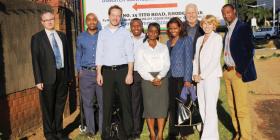
A one-day workshop introduced participants to the potential of space-based technologies for disaster management and to best practices, and looked at options to improve their usage in Zambia.
Zambia is in many ways advanced in its use of technology and its ability to use geospatial data. Its main needs are to set up a national spatial data infrastructure, to expand data-sharing, and to obtain access to regular Earth observations and high-resolution data from public and commercial sources.
- To collect additional remote sensing data and analysis for early warning;
- To collect weather information in real time and to set up a denser network of weather stations to provide more accurate and timely information about the local situation;
- To compile climate change resiliency information and related plans;
- To set up flood plain and risk mapping and an early warning system for floods; (e) To develop flash flood modelling and prediction capabilities;
- To build capacity for remote sensing and the geographic information system and raise awareness, making optimal use of low-cost approaches and free data sources, applications, technologies and services;
- To set up a fire warning system, recruit more fire watch staff and acquire more fire watch facilities and modelling tools;
- To collect specific upper atmospheric data and models;
- To develop a national high resolution digital elevation model;
- To promote access to radar imagery and develop related processing capability.
