Incendio
Definition
Facts and figures
Further information
UN-SPIDER Regional Support Offices with hazard-specific expertise
Related content on the Knowledge Portal
A new report by the world’s largest humanitarian aid network highlights global disasters, populations most vulnerable to them and the efforts of local institutions in preventing, preparing for and responding to them. The 2020 edition of the World Disasters Report, “Come Heat or High Water”, was launched virtually from the offices of the International Federation of Red Cross and Red Crescent Societies (IFRC) in Vienna on November 16. This year’s report discusses climate- and weather-related disasters and their humanitarian impact. It argues for the usefulness of smart financing and space-based information in disaster management support.
The report warns that the global effort to address climate change is leaving behind countries...
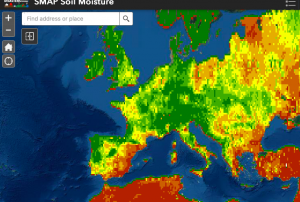
read more19/11/2020Officially launched in 2015 by the National Aeronautics and Space Administration (NASA), the SMAP mission is an orbiting satellite that measures the amount of wetness in the top layer of soil incrementally every 2-3 days. These Soil Moisture Active Passive (SMAP) measurements rely on radiation frequencies that point to different levels of moisture on the surface of earth’s soil and are useful for scientists because it allows them to construct maps indicating the level of soil moisture globally. Acknowledging the relevance and usability of this data for the field of disaster management, NASA recently integrated the SMAP data into its Disasters Mapping Portal.
The Disasters Mapping Portal has been developed by the Geographic Informations Systems (GIS) Team at NASA in an effort to make their...
read more25/11/2020A new programme aims to prevent and countermand the loss of tropical forests by facilitating the global availability of high-resolution satellite imagery. Launched by Norway’s Ministry of Climate and Environment in partnership with satellite imagery providers Kongsberg Satellite Services, Planetand Airbus, the Imagery Programme makes use of space-based information to combat the devastating effects of climate change, mitigate disasters and facilitate disaster management efforts worldwide.
Trees are vital for upholding an environmental equilibrium and deforestation causes a disruption with devastating effects on our climate. Meaningfully, the positive correlation between deforestation and global warming is widely recognized. The impact of deforestation on the environment can be...
read more08/12/2020The European Commission plans to rapidly expand its environmental monitoring programme Copernicus. For this purpose, the European Space Agency (ESA) recently pledged 2.55 billion Euros towards contracts to advance the production of six new Copernicus satellite missions. The final of the six contracts was signed last Thursday between ESA and Thales Alenia Space for a mission that will provide new and important information to climate research and disaster management.
The high-priority Copernicus Radar Observation System for Europe in L-band (ROSE-L) mission is planned to launch in 2028 for a period of 7.5 years. The ROSE-L mission will orbit Earth every few days at an altitude of 690km and will carry a L-Band synthetic aperture radar (SAR). With a wavelength of approximately 23cm, an...
read more18/12/2020The Disasters programme unit at the National Aeronautics and Space Administration (NASA) recently joined a newly launched online platform aimed at placing anticipatory action on the humanitarian agenda. NASA’s involvement in the Anticipation Hub and the subsequent incorporation of Earth observation (EO) tools, serves to improve the capabilities of anticipatory action globally and demonstrates the potential of utilizing satellite-driven data for anticipatory action in disaster management.
Anticipatory action in the humanitarian context describes disaster mitigation activities based on in-depth forecast information and risk analysis. This approach has gained traction amongst the humanitarian community in recent years as it is viewed as a more efficient and affordable alternative...
read more02/02/2021A knowledge platform for adaptation action on climate change recently updated the information, layout and logo of their website. With this step, adaptationcommunity.net aims to improve the user experience of the online platform and consequently facilitate the access to a wide variety of resources on climate change adaptation action, including tools working with Earth observation data.
Adaptation action in the context of climate change refers to “adjustments in ecological, social, or economic systems in response to actual or expected climatic stimuli and their effects or impacts. It refers to changes in processes, practices, and structures to moderate potential damages or to benefit from...
read more12/02/2021A new report outlines the impact of Global Human Settlement Layer (GHSL) data on various policy areas. The 2020 edition of the “Atlas of the Human Planet”, recently published and launched virtually by the Joint Research Centre (JRC) of the European Commission as a deliverable to the Group on Earth Observations (GEO) Human Planet Initiative, explores the impact of GHSL data on various policy areas, including disaster risk management.
GHSL data refers to “global spatial information, evidence-based analytics and knowledge describing the human presence on the planet”. This data relies on spatial information from Landsat 8, Sentinel-1 and Sentinel-2. It is mainly cost-free and...
read more18/02/2021- Publishing institution:
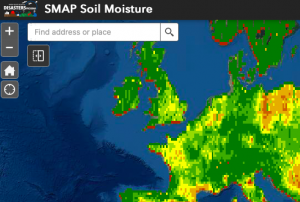
Officially launched in 2015 by the National Aeronautics and Space Administration (NASA), the SMAP mission is an orbiting satellite that measures the amount of wetness in the top layer of soil incrementally every 2-3 days. These Soil Moisture Active Passive (SMAP) measurements rely on radiation frequencies that point to different levels of moisture on the surface of earth’s soil and are useful for scientists because it allows them to construct maps indicating the level of soil moisture globally. Acknowledging the relevance and usability of this data for the field of disaster management, NASA recently integrated the SMAP data into its Disasters Mapping Portal.
The Disasters Mapping Portal has been developed by the Geographic Informations Systems (GIS) Team at NASA in an effort to make their satellite...
read more25/11/2020A new report by the world’s largest humanitarian aid network highlights global disasters, populations most vulnerable to them and the efforts of local institutions in preventing, preparing for and responding to them. The 2020 edition of the World Disasters Report, “Come Heat or High Water”, was launched virtually from the offices of the International Federation of Red Cross and Red Crescent Societies (IFRC) in Vienna on November 16. This year’s report discusses climate- and weather-related disasters and their humanitarian impact. It argues for the usefulness of smart financing and space-based information in disaster management support.
The report warns that the global effort to address climate change is leaving behind...
read more19/11/2020


