Hydrological
Definition
UN-SPIDER Regional Support Offices with hazard-specific expertise
Related content on the Knowledge Portal
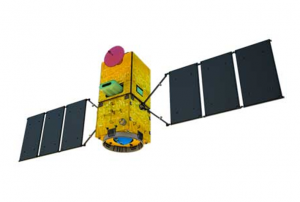
Amazônia-1 is the first Earth Observation satellite completely designed, integrated, tested and operated by Brazil. It features the optical Advanced Wide Field Imager (AWFI), with swath width 850 km and 60 m resolution, capturing images in 3 visible bands and 1 near-infrared (NIR) band. It has a high revisit period of 5 days, which is important for increasing the probability of capturing useful images over frequently overcast areas including the Amazon region. The data will be accessible to the scientific community, government agencies, and to users interested in a better understanding of the terrestrial environment. The Amazon mission is planned to have three remote sensing satellites: Amazonia-1, followed by Amazonia-1B and Amazonia-2.
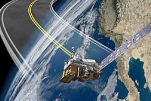
28/02/2021NOAA-20, designated JPSS-1 prior to launch, is the first of the United States National Oceanic and Atmospheric Administration's latest generation of U.S. polar-orbiting, non-geosynchronous, environmental satellites called the Joint Polar Satellite System. NOAA-20 was launched on 18 November 2017 and joined the Suomi National Polar-orbiting Partnership satellite in the same orbit. NOAA-20 operates about 50 minutes ahead of Suomi NPP, allowing important overlap in observational coverage. Circling the Earth from pole-to-pole, it crosses the equator about 14 times daily, providing full global coverage twice a day. This will give meteorologists information on "atmospheric temperature and moisture, clouds, sea-surface temperature, ocean color, sea ice cover, volcanic ash, and fire detection" so as to enhance weather forecasting including hurricane tracking, post-hurricane recovery by detailing storm damage and mapping of power outages.
The project incorporates five instruments,…
read more18/11/2017- 02/11/2016
Peru’s first Earth Observation satellite was commissioned by the Peruvian government for its national space agency, CONIDA (Comisión Nacional de Investigación y Desarrollo Aeroespacial) in 2014, and constructed in a record time of less than 24 months. PerúSAT-1 features the very-high-resolution optical New AstroSat Optical Modular Instrument (NAOMI) imager designed and developed by Airbus Defence and Space. This silicon carbide optical instrument provides panchromatic images with 70 cm spatial resolution and multispectral images in up to 2 m spatial resolution. PerúSAT-1 is based on Airbus Defence and Space’s AstroBus-S platform, and captures up to 300 images covering an area of 63, 000 km2 per day.
16/09/2016Himawari 8 is a Japanese weather satellite, the 8th of the Himawari geostationary weather satellites operated by the Japan Meteorological Agency. The spacecraft was constructed by Mitsubishi Electric with assistance from Boeing, and is the first of two similar satellites to be based on the DS-2000 satellite bus. Himawari 8 entered operational service on 7 July 2015 and is the successor to MTSAT-2 (Himawari 7) which was launched in 2006.
07/10/2014ESA’s Soil Moisture and Ocean Salinity (SMOS) mission is dedicated to making global observations of soil moisture over land and salinity over oceans.
The SMOS satellite carries a novel interferometric radiometer that operates in the L-band microwave range to capture ‘brightness temperature’ images.
These images are used to derive global maps of soil moisture every three days, achieving an accuracy of 4% at a spatial resolution of about 50 km. Over oceans, SMOS maps salinity down to 0.1 practical salinity units (psu, averaged over 10–30 days in areas measuring 200 × 200 km).
read more02/11/2009- 01/08/1997
- 01/08/1996
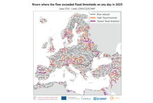
The Copernicus Climate Change Service (C3S), along with the World Meteorological Organization (WMO) have recently released their 2023 European State of the Climate report (ESOTC 2023), which included a number of key findings in regards to the climatological conditions around Europe, including and overview of the extensive flooding and temperature conditions around the region.
Along with a variety of maps detailing the differential coverage and intensity of these conditions, they have found that the temperatures in Europe were above average for 11 months of the year, and a third of the river networks exceeded the ‘high’ flood threshold (with 16% reaching the ‘severe’ flood threshold).
In a press release containing an overview of the report, the organizations discussed a number of topics including the general trend of climate change and warming temperatures, the subsequent health impacts these may have on the people in Europe, a brief discussion on the seasonal…
read more06/05/2024Natural disasters are becoming more frequent and intense across the globe. Enhancing resilience to increasing hazards, exposure, and vulnerability therefore requires leveraging of advanced geospatial technologies for better disaster mitigation and management. With continuous improvements in satellite data sensor acquisition parameters together with geo-computational approaches, geospatial technologies have emerged as the most powerful technology for all phases of disaster management. The course on advanced geospatial technologies for Disaster Risk Reduction (DRR) is scheduled from April 18 - 29, 2022 .
Course Content
- Overview of remote sensing & Geographic Information System
- Application of satellite communication technology for disaster mitigation
- Overview of UAV for disaster monitoring and mitigation
- Emerging geo computation, online GIS & Geo-web services for DRR
- Advanced application of Geospatial…


