![]()
United
Nations
Flood
, processed by ESA, CC BY-SA 3.0 IGO.")
Definition
Facts and figures
Further information
UN-SPIDER Regional Support Offices with hazard-specific expertise
Related content on the Knowledge Portal
")
Zambia is experiencing severe flooding in Southern, Central, Lusaka provinces, thousands of people have been affected with the worst impacted areas being the districts of Luapula, Kapompo, Lukulu, Senanga, Kitwe, Mambwe, and Solwezi.
The Water Resources Management Authority (WARMA) has been issuing flood warnings since mid-January. Some rivers are expected to be high or experience a second peak well into February, including the Luapala river in Milenge district, the Kafue river in Kitwe district, and the Zambezi river in Lukulu and Senanga districts.
An estimated 15,000 people from 3,500 households were affected by flooding in Southern Province in January the year before.
Following the guidance of the International Water Management Institute (IWMI), one of the UN-SPIDER Regional Support Offices, UNOOSA/UN-SPIDER requested the activation of the International Charter Space and Major Disasters on behalf of the Disaster Management and Mitigation Unit (DMMU…
read more on October 31, 2022. Image: Sentinel 2A (The International Charter Space and Major Disasters)")
Tropical Storm Nalgae (known as Paeng in the Philippines) unleashed floods and landslides in the Philippines, killing at least 45 people.
Provinces and cities in the south were hit the hardest by the storm. The Bangsamoro Autonomous Region in Muslim Mindanao (BARMM) was put under a state of emergency due to severe flooding.
Authorities reported that close to 185,000 people across the country were affected by the storm.
UNOOSA/UN-SPIDER requested the activation of the International Charter Space and Major Disaters on behalf of the Philippine Space Agency (PhilSA) and the National Disaster Risk Reduction and Management Council (NDRRMC).
read moreOrganization Title …")
Typhoon Noru made landfall in the Philippines main Luzon island on 25 September 2022, prompting warnings that heavy winds and torrential rain could cause severe flooding. Known locally as Typhoon Karding, the storm intensified rapidly arriving as a super typhoon with maximum sustained winds of 240 kilometers per hour.
The National Disaster Risk Reduction and Management Council reported that the highest emergency response protocol was activated in Metro Manila, Central Luzon, Calabarzon, Mimaropa, and the Bicol region. Five rescue workers in the Philippines were killed and many homes flooded leaving millions without electricity. President Marcos ordered that supplies be airlifted and clean-up equipment provided to communities that were most affected.
UNOOSA/UN-SPIDER activated the International Charter Space and Major Disasters on behalf of the Philippine Space Agency (PhilSA) and the National Disaster Risk Reduction and Management Council (NDRRMC).
…
read more")
Hurricane Fiona unleashed heavy rain on the Dominican Republic,as it made landfall on 19 September.
The storm displaced more than 12,400 people, caused landslides, fallen bridges, road blockages, power outages, interrupted telecommunications, and overflowing dams .
Authorities closed ports and beaches; a tourist pier in the town of Miches was badly damaged by high waves. At least four international airports were closed.
The Dominican Red Cross activated and deployed national teams to carry out sectoral assessments and interventions in health, water, sanitation and hygiene promotion and psychosocial support; especially in the provinces that were most impacted.
UNOOSA/UN-SPIDER requested the activation of the International Charter Space and Major Disasters on behalf of the National Emergency Commission of the Dominican Republic.
… read more")
Tropical Storm Ma-On (known as Florita in the Philippines) passed over the northern Philippines on 23 August, causing flooding.
Ma-On made landfall at Maconacon Town in Isabela Province, where thousands of people in the region were evacuated as a precaution. However, during the storm a passenger bus crashed, leaving two dead and six injured. Trees in Tuguegarao toppled power lines, cutting off electricity to an estimated 28 towns in Cagayan Province. River banks spilled over to nearby areas, and Ma-On caused storm surges on the coast.
The storm moved west over Manila and out into the South China Sea on 24 August.
UNOOSA/UN-SPIDER requested the activation of the International Charter Space and Major Disasters on behalf of the Philippine Space Agency (PhilSA) and the National Disaster Risk Reduction and Management Council (NDRRMC).
… read more")
Tropical Storm Megi (also known as Agaton) passed over the Philippines on 10 April, causing landslides and floods in its wake.
The storm struck the east and south coasts of the archipelago, particularly affecting Western Visayas, Eastern Visayas and Craga regions.
35,000 people were evacuated before the storm arrived, and it is estimated that as many as 200,000 have had to leave their homes since then to move to safer locations. Estimates suggest almost a million people may be affected by the disaster.
76 people have been reported killed due to floods and landslides, after rivers burst their banks and debris from hills was washed down, and villages near Baybay City have been badly affected.
UNOOSA/UN-SPIDER requested the activation of the International Charter Space and Major Disasters on behalf of the Philippine Space Agency (PhilSA) and the Philippine National Disaster Risk Reduction and Management Council (NDRRMC)
… read more")
According to the National Institute for Disaster Risk Reduction of Mozambique (INGD), Cyclone Gombe made landfall as a Category 3 Tropical Cyclone on 11 March on the coast of Mozambique between Mossuril and Mogincual districts (Nampula Province).
Preliminary impacts reported by INGD indicate that many houses and power lines were destroyed or damaged; twelve people have been reported killed, several have been injured, and overall more than thirty thousand people have been affected. Over one hundred schools were reported damaged or destroyed, one bridge collapsed, and several roads were affected.
UNOOSA/UN-SPIDER requested the activation of the International Charter Space and Major Disasters on behalf of the National Institute for Disaster Risk Reduction of Mozambique (INGD).
read more… ")
Tropical storm Ana has killed at least eight people in Mozambique after making landfall on 24 January, bringing heavy rains and strong winds.
Ana is reported to have affected thousands of people, causing damage to homes and other infrastructure.
The storm reached Mozambique a day after passing over Madagascar. Ana gained strength as it traversed the channel, forming into a Tropical Storm before it made landfall.
UNOOSA/UN-SPIDER requested the activation of the charter on behalf of the National institute for Disaster Risk Reduction of Mozambique (INGD) and the Department of Disaster Management Affairs of Malawi.
read moreOrganization …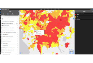
This is an excerpt from an article by NASA Earth Science, Applied Sciences.
Floods are among the most deadly and destructive disasters worldwide, and climate change has only increased their severity. To make matters worse, many smaller communities lack the tools they need to detect and respond to floods, leaving them vulnerable to the full force of their impacts.
To help protect these communities, NASA's Earth Applied Sciences Disasters program area has partnered with several leading scientific institutions to develop a new flood detection tool called "Model of Models" (MoM). This tool combines data from open-source hydrological models with Earth observing satellite data to generate global flood risk severity updates several times a day. This is the first time that comprehensive global flood early warnings have…
read more05/01/2023
The Copernicus Emergency Management Service (CEMS) is organising the ‘2nd Global Flood Forecasting and Monitoring Meeting’ which will be hosted online via Zoom Webinar and the Gather.Town platform on Wednesday 08 and Thursday 09 February 2023.
To register for the event, please click on the Zoom Webinar registration link to enter your details. Registration for the workshop will remain open until the 31 January 2023.
The event focuses on recent advances in …
read more
Term Parents
UN-SPIDER Regional Support Offices with hazard-specific expertise
![]()