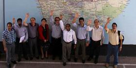
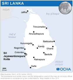
The mission team was headed by two experts from UN-SPIDER, and was complemented with seven experts from UNESCAP, Z_GIS - University of Salzburg (Austria), CSSTEAP, SUPARCO, IWMI and the K.N.Toosi University of Technology (Iran).
The mission included meetings with key stakeholders within the government, associated departments/agencies and UN offices. In total eleven different institutions were consulted. In addition UN-SPIDER and DMC organised a one day workshop on 20 October 2011 bringing together more than 75 representatives from various government/UN agencies and academia of the country to discuss cross cutting issues related to use of geographic and space-based information for disaster risk reduction and emergency response.
Disaster-risk management efforts are implemented through the DMC and with the support of a variety of international organizations and NGOs. The DMC is well place and capable of coordinating inter-institutional efforts. Efforts are conducted under the umbrella of the national plan entitled: Towards a safer Sri Lanka: A road map for Disaster Risk Management;
The Disaster Management Centre is aware of the International Charter: Space and Major Disasters and of UN-SPIDER. The Survey Department is also aware of Sentinel Asia and participates in efforts conducted by Sentinel Asia. However, the products from these mechanisms are not yet contributing to the decision-making process;
Space based information has been already employed in the case of hydrometeological events;
Several organizations such as the National Building Research Organisation (NBRO) have carried out hazard assessments, and the DMC is promoting the elaboration of risk assessment;
There is no national-level data or information sharing mechanism, nor a national Geospatial Database Infrastructure in place to facilitate the sharing of data and information among institutions. However, some institutions have their own spatial database infrastructure, such as the Survey Department;
The DMC is aware of the value of geo-spatial information but lack the capacities to make use of space-based information for risk management and emergency response efforts. There is a recognition regarding the need to build capacities within the DMC;
The Government of Sri Lanka should incorporate the use of space-based information in its policies related to disaster-risk management and emergency response as a way to take advantage of the opportunities that are being made available by the space community, including mechanisms such as the Charter and Sentinel Asia;
The Ministry of Disaster Management should incorporate policy interventions to define clear cooperation and information sharing mechanism between data provider organisations, to leverage on best practice and policy interventions to strengthen organisations mandated to play critical role in early warning;
The issue of the Geospatial Data Infrastructure should be taken up on top priority to avoid huge wastage of resources. The Information and Communication Technology Agency (ICTA), the Survey Department and the Arthur C Clarke Institute for Modern Technologies should play key role in implementing the National Spatial Data Infrastructure (NSDI);
The right to access data for the different institutions and their needs of a comprehensive disaster management has to be maintained. Financial provisions to access satellite images should be maintained. The aerial coverage during emergencies could be improved by the Air force through especially equipped plane;
An appropriate methodology and concept to integrate Earth Observation, spatial data and additional socio-economic data into a vulnerability assessment should be maintained. The overall integration into a risk profile will need further attention;
The Ministry for Disaster Management and the DMC should carry out specific training programmes targeting offices involved in national risk profiling and early warning as well as strengthening technical infrastructure of departments involved in DRM for analysis of satellite data and processing of geospatial information;
The DMC should carry out frequent awareness activities targeting decision makers and stakeholders in collaboration with Sri Lanka Institute of Development Administration (SLIDA) on the benefits of space-based information.


