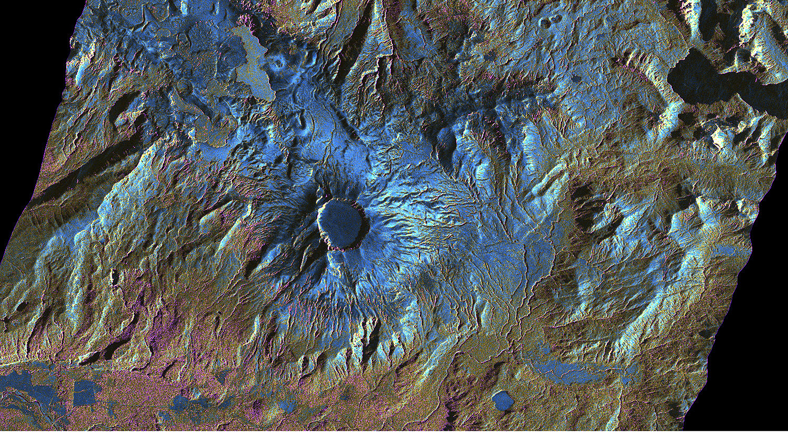
The crater of the Chilean volcano Puyehue displays a striking, circular outline in this image from the German Aerospace Center (Deutsches Zentrum für Luft- und Raumfahrt; DLR) TerraSAR-X satellite – so this was not the culprit when a volcano in the southern Andes erupted on 4 June 2011. Instead, as the images from the German radar satellite show for the first time, the new eruption centre lies 6.7 kilometres further to the northwest, in the Cordón Caulle region. A field of lava, appearing as a uniform, light blue surface, is currently forming there. Radar images acquired by TerraSAR-X have been providing valuable information to the staff of the Chilean Volcano Risk Programme since the eruption began, helping them to assess the situation and predict its future development.
DLR's Center for Satellite Based Crisis Information (Zentrum für satellitengestützte Kriseninformation; ZKI) confirmed 40.525 degrees South, 72.142 degrees West as the coordinates of the eruption, which they reported to their Chilean colleagues when the natural disaster began. The 'International Charter on Space and Major Disasters' had asked DLR to supply satellite data about this emergency. "The TerraSAR-X images were very useful to us in confirming the location of the site of the eruption," explained geologist Luis E. Lara of the National Geology and Mining Service's (Servicio Nacional de Geología y Minería) Volcano Risk Programme (Programa de Riesgos Volcánicos) in Chile. The volcano expert coordinated the work of a team of experts and their collaboration with other national authorities and organisations in Chile. Scientists on site had already observed that the River Nilahue in the national park was at a temperature of over 45 degrees Celsius, so an eruption in the vicinity of its source was likely. Only the optical data contradicted this assumption: "optical satellite data suggested an eruption site further west." Up to this point, the experts had only been able to observe the volcano from great distances on the ground or during a few cautious overflights, but the cloud cover and large distances made it difficult to assess the situation precisely: "but the exact location of the volcanic vent was extremely important for our computer calculations of the distribution of the ash cloud."
In contrast, the cloud cover was no obstacle for the TerraSAR-X radar satellite, as the radar signals are unaffected by weather. "The ash cloud itself only slightly affected the radar signals, so that the view of the volcano complex in the TerraSAR-X images is almost undisturbed," said Robert Metzig, from the German Remote Sensing Data Center (Deutsches Fernerkundungsdatenzentrum; DFD). "On the other hand, the effect of the ash particles is still sufficient to clearly identify the eruption column and hence the active crater." Just five days after the location of the new crater had been determined using the images obtained with TerraSAR-X, the weather conditions enabled a flight close to the eruption centre for the first time. The flight confirmed that DLR scientists had accurately calculated the location of the new crater using the radar data.
To read the entire article: www.dlr.de/dlr/en/desktopdefault.aspx/tabid-10481/761_read-957/