![]()
United
Nations
AIRS precipitation (NASA)
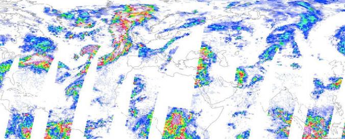
| Data provided by: | National Aeronautics and Space Administration (NASA) |
| Data accessibility: | Exportar datos, Exportar mapa, Visualización de datos (ej. web SIG o monitoreo en tiempo real) |
| Link to the data: | |
| Requirements: | Registration is needed |
| Data type: | Datos sobre amenazas específicas |
| Hazard: | Drought, Flood, Severe Storm |
| Disaster cycle phase: | Gestión des Riesgo por Desastres, Respuesta, Recuperación |
| Spatial coverage: | Global |
| Temporal coverage: | Archivado, Casi en tiempo real |
| Technical Specifications: | |
| Costs: | Gratis |
Provider
![]()