• English
  • Español
  • Français

United
Nations


Office for Outer Space Affairs
UN-SPIDER Knowledge Portal

  • Inicio
  • Sobre nosotros
    • Sobre ONU-SPIDER
    • Acerca de UNOOSA
    • Publicaciones
    • Ofertas de trabajo
    • Conozca el Equipo
    • Contacto
  • Aplicación Espacial
    • Guías Tecnológicas
    • Mecanismos de Emergencia
    • Mecanismos de Recuperación
    • Red Internacional de Alerta de Asteroides
    • Grupo Asesor para la Planificación de Misiones Espaciales
    • Iniciativa Internacional sobre Meteorología Espacial
    • Tecnologías Espaciales en la ONU
    • Historias de Usuarios
  • Enlaces y Recursos
    • Aplicación de datos del mes
      • Disaster Recovery
    • Fuentes de Datos
    • SIG y Software de Percepción Remota
    • Recursos de capacitación en línea
    • Instituciones
  • Riesgos y Desastres
    • Gestión del Riesgo de Desastres
    • Alerta temprana
    • Gestión de Desastres y Emergencias
    • Amenazas Naturales
    • El Proceso de la Reducción de Desastres Post-2015
    • La ONU y la Gestión del Riesgo de Desastres
    • La ONU y Alerta Temprana
    • La ONU y la Gestión de Desastres
  • Asesoría
    • Misiones de Asesoría
    • Apoyo en caso de Emergencia
    • Asesoría Virtual
    • Prácticas Recomendadas
    • Actividades de Entrenamiento
    • Usos Prácticos
  • Redes
    • Oficinas Regionales de Apoyo
    • GP-STAR
    • IN-MHEWS
    • IWG-SEM
  • Proyectos
    • SPEAR
    • FOSAT-S
    • EvIDENz
    • Flood GUIDE
  • Noticias y Eventos
    • Noticias
    • Eventos
    • Eventos pasados

Breadcrumb

  • Home
  • IGAC: Development of Forest Fire Detection And Classification App
  • IGAC: Development of Forest Fire Detection and Classification App

IGAC: Development of Forest Fire Detection and Classification App

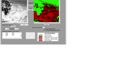
Classification of a Forest Fire in Salamanca Island Road Park, Colombia, based on a 8 LDCM Landsat imageClassification of a Forest Fire in Salamanca Island Road Park, Colombia, based on a 8 LDCM Landsat image (Image: IGAC)

The Research and Development in Geographic Information Centre (CIAF) of IGAC, UN-SPIDER's Regional Support Office in Colombia, is working on the development of tools for disaster management and disaster relief.

One of its products is an application called SEMARK (Forest Fire Severity Markov Classification), which is the result of research conducted within the framework of a PhD thesis on the use of remote sensing techniques in forest fires.

SEMARK creates classifications of spectral indices derived from satellite imagery (NBR, NDVI, and SAVI) classifiers using Markov random fields (MRF). Based on the results, SEMARK can be used as an initial tool in the identification and quantification of areas affected by forest fires.

More information: alexander.ariza@igac.gov.co and sergio.rojas@igac.gov.co

Wed, 17 Sep 2014 - 10:21
Colombia
Colombia Regional Support Office

Footer menu

  • Contact
  • Terms of Use

User account menu

  • Log in