Skip to main content
English
Español
Français
United
Nations
Office for Outer Space Affairs
UN-SPIDER Knowledge Portal
Buscar
Inicio
Sobre nosotros
Sobre ONU-SPIDER
Acerca de UNOOSA
Publicaciones
Ofertas de trabajo
Conozca el Equipo
Contacto
Aplicación Espacial
Guías Tecnológicas
Mecanismos de Emergencia
Mecanismos de Recuperación
Red Internacional de Alerta de Asteroides
Grupo Asesor para la Planificación de Misiones Espaciales
Iniciativa Internacional sobre Meteorología Espacial
Tecnologías Espaciales en la ONU
Historias de Usuarios
Enlaces y Recursos
Aplicación de datos del mes
Disaster Recovery
Fuentes de Datos
SIG y Software de Percepción Remota
Recursos de capacitación en línea
Instituciones
Riesgos y Desastres
Gestión del Riesgo de Desastres
Alerta temprana
Gestión de Desastres y Emergencias
Amenazas Naturales
El Proceso de la Reducción de Desastres Post-2015
La ONU y la Gestión del Riesgo de Desastres
La ONU y Alerta Temprana
La ONU y la Gestión de Desastres
Asesoría
Misiones de Asesoría
Apoyo en caso de Emergencia
Asesoría Virtual
Prácticas Recomendadas
Actividades de Entrenamiento
Usos Prácticos
Redes
Oficinas Regionales de Apoyo
GP-STAR
IN-MHEWS
IWG-SEM
Proyectos
SPEAR
FOSAT-S
EvIDENz
Flood GUIDE
CommonSpace Initiative
Tonga Pilot Project
Noticias y Eventos
Noticias
Eventos
Eventos pasados
Breadcrumb
Home
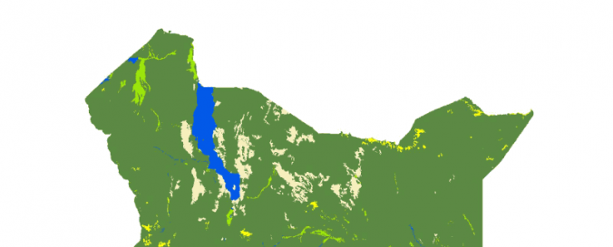
Land Cover, Kenya (Africover, FAO)
Land Cover, Kenya (Africover, FAO)
Land Cover, Kenya (Africover, FAO)
Data provided by:
Food and Agriculture Organization of the United Nations (FAO)
Data accessibility:
Exportar datos
Link to the data:
Metadata and download: SPATIALLY AGGREGATED MULTIPURPOSE LANDCOVER DATABASE FOR…
Metadata and download: TOWNS OF KENYA - AFRICOVER
Metadata and download: RIVERS OF KENYA - AFRICOVER
Metadata and download: ROADS OF KENYA - AFRICOVER
Metadata and download: BOUNDARIES OF KENYA - AFRICOVER
Metadata and download: GEOMORPHOLOGY - LANDFORM AND LITHOLOGY FOR KENYA - AFRIC…
Metadata and download: LITHOLOGY FOR KENYA - THEMATIC AGGREGATION GEOMORPHOLOGY…
Metadata and download: LANDFORM FOR KENYA - THEMATIC AGGREGATION GEOMORPHOLOGY …
Metadata and download: THEMATIC GRASSLAND AGGREGATION FOR KENYA - AFRICOVER
Metadata and download: THEMATIC WOODY AGGREGATION FOR KENYA - AFRICOVER
Metadata and download: THEMATIC AGRICULTURE AGGREGATION FOR KENYA - AFRICOVER
File type:
shp
,
shp
,
shp
Data type:
Datos sobre el use suelo, cobertura del terreno
Disaster cycle phase:
Gestión des Riesgo por Desastres
Satellites and Sensors:
Landsat 4
Spatial coverage:
Kenya
Spatial resolution:
30.00
Temporal coverage:
Archivado
Content dates:
1999
Technical Specifications:
About Africover
Costs:
Gratis
Contact:
GIS-Manager@fao.org
Provider