• English
  • Español
  • Français

United
Nations


Office for Outer Space Affairs
UN-SPIDER Knowledge Portal

  • Inicio
  • Sobre nosotros
    • Sobre ONU-SPIDER
    • Acerca de UNOOSA
    • Publicaciones
    • Ofertas de trabajo
    • Conozca el Equipo
    • Contacto
  • Aplicación Espacial
    • Guías Tecnológicas
    • Mecanismos de Emergencia
    • Mecanismos de Recuperación
    • Red Internacional de Alerta de Asteroides
    • Grupo Asesor para la Planificación de Misiones Espaciales
    • Iniciativa Internacional sobre Meteorología Espacial
    • Tecnologías Espaciales en la ONU
    • Historias de Usuarios
  • Enlaces y Recursos
    • Aplicación de datos del mes
      • Disaster Recovery
    • Fuentes de Datos
    • SIG y Software de Percepción Remota
    • Recursos de capacitación en línea
    • Instituciones
  • Riesgos y Desastres
    • Gestión del Riesgo de Desastres
    • Alerta temprana
    • Gestión de Desastres y Emergencias
    • Amenazas Naturales
    • El Proceso de la Reducción de Desastres Post-2015
    • La ONU y la Gestión del Riesgo de Desastres
    • La ONU y Alerta Temprana
    • La ONU y la Gestión de Desastres
  • Asesoría
    • Misiones de Asesoría
    • Apoyo en caso de Emergencia
    • Asesoría Virtual
    • Prácticas Recomendadas
    • Actividades de Entrenamiento
    • Usos Prácticos
  • Redes
    • Oficinas Regionales de Apoyo
    • GP-STAR
    • IN-MHEWS
    • IWG-SEM
  • Proyectos
    • SPEAR
    • FOSAT-S
    • EvIDENz
    • Flood GUIDE
  • Noticias y Eventos
    • Noticias
    • Eventos
    • Eventos pasados

Breadcrumb

  • Home
  • Crowdsource Mapping: HOT Reboots OpenAerialMap Project
  • Crowdsource Mapping: HOT reboots OpenAerialMap project

Crowdsource Mapping: HOT reboots OpenAerialMap project

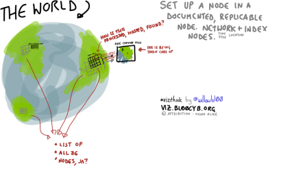
Visualization of the OpenAerialMap conceptVisualization of the OpenAerialMap concept

In 2007, the crowdsource mapping community OpenStreetMap launched a project called "OpenAerialMap" (OAM). Due to several challenges, such as scaling the hosting and licensing, the project was shot down after a year. Now, the Humanitarian OpenStreetMap Team (HOT) launched a new attempt of the project.

With funding from the Humanitarian Innovation Fund, OpenAerialMap seeks to make imagery from satellites, Unmanned Aerial Vehicles (UAVs) and other aircraft available to support humanitarian response and disaster preparedness.

In a recent blogpost, HOT elaborates: "OpenAerialMap will be a distributed catalogue and hosting service of imagery. A user will be able to go to OAM and search to see what free imagery is available in the area they are interested in. Imagery in this case means georeferenced photos from satellites, UAVs or other aircraft. Key to its availability and accessibility is that OAM will be a distributed system, meaning that responsibility will rest with the commons and not any one organisation."
HOT Blog
Wed, 9 Jul 2014 - 10:35

Footer menu

  • Contact
  • Terms of Use

User account menu

  • Log in