The UN-SPIDER Recommended Practice on flood hazard mapping shows how GIS and modelling are used to calculate simulated inundation areas based on land use, soil, elevation, and meteorological data. Flood simulations can be used to support decision-making regarding potential land use changes. This step-by-step procedure was developed by the Lyes School of Civil Engineering at Purdue University, United States of America. The model presented below has been applied to the Cedar Creek watershed, but could be applied to any watershed as long as the necessary data (e.g. land cover, digital elevation model, soil information) are available.
Flood prediction and modeling refers to the processes of transformation of rainfall into a flood hydrograph and to the translation of that hydrograph throughout a watershed or any other hydrologic system. In this context, the aim of this Practice is providing guidance in how to determine the extension of flooded areas by using hydro data model together with powerful GIS tools used to model flood hazards (i.e.Geo HEC-HMS).
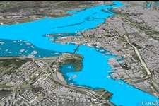
Cedar Creek watershed/ St. Joseph basin, northeast Indiana, USA
The Cedar Creek is located in northeast Indiana, USA. It is the largest tributary to the St. Joseph river. Soil types on the watershed were formed from compacted glacial till and fluvial materials. The predominate soil textures in the immediate Cedar Creek are silt loam, silty clay loam, and clay loam. The average annual precipitation in the watershed is approximately 900mm. The average temperature during crop growth seasons ranges from 10 to 23 degrees Celsius. Approximately 76% of the watershed area is agriculture, 21% forested lands, and 3% urban. The majority of the agricultural lands are rotationally tilled predominantly with corn and soybeans, with lesser amounts of wheat and hay (cf. Larose et al. 2007).
The model has been applied to the Cedar Creek watershed. In general, it could be applied to any watershed as long as the necessary data (e.g. land cover, digital elevation model, soil information) are available.
Datos relacionados
Software relacionado
Descargo de responsabilidad:
Por favor tome nota que ni ONU-SPIDER ni las Oficinas Regionales de Apoyo o sus socios se responsabilizan por la calidad de los resultados que se obtienen usando esta práctica recomendad o las decisiones que se tomen con estos resultados.