• English
  • Español
  • Français

United
Nations


Office for Outer Space Affairs
UN-SPIDER Knowledge Portal

  • Inicio
  • Sobre nosotros
    • Sobre ONU-SPIDER
    • Acerca de UNOOSA
    • Publicaciones
    • Ofertas de trabajo
    • Conozca el Equipo
    • Contacto
  • Aplicación Espacial
    • Guías Tecnológicas
    • Mecanismos de Emergencia
    • Mecanismos de Recuperación
    • Red Internacional de Alerta de Asteroides
    • Grupo Asesor para la Planificación de Misiones Espaciales
    • Iniciativa Internacional sobre Meteorología Espacial
    • Tecnologías Espaciales en la ONU
    • Historias de Usuarios
  • Enlaces y Recursos
    • Aplicación de datos del mes
      • Disaster Recovery
    • Fuentes de Datos
    • SIG y Software de Percepción Remota
    • Recursos de capacitación en línea
    • Instituciones
  • Riesgos y Desastres
    • Gestión del Riesgo de Desastres
    • Alerta temprana
    • Gestión de Desastres y Emergencias
    • Amenazas Naturales
    • El Proceso de la Reducción de Desastres Post-2015
    • La ONU y la Gestión del Riesgo de Desastres
    • La ONU y Alerta Temprana
    • La ONU y la Gestión de Desastres
  • Asesoría
    • Misiones de Asesoría
    • Apoyo en caso de Emergencia
    • Asesoría Virtual
    • Prácticas Recomendadas
    • Actividades de Entrenamiento
    • Usos Prácticos
  • Redes
    • Oficinas Regionales de Apoyo
    • GP-STAR
    • IN-MHEWS
    • IWG-SEM
  • Proyectos
    • SPEAR
    • FOSAT-S
    • EvIDENz
    • Flood GUIDE
  • Noticias y Eventos
    • Noticias
    • Eventos
    • Eventos pasados

Breadcrumb

  • Home
  • System To Track Drought Dynamics Developed By University of Cincinnati Geographers
  • System to Track Drought Dynamics developed by University of Cincinnati Geographers

System to Track Drought Dynamics developed by University of Cincinnati Geographers

Geographers Develope System to Track Drought Dynamics Geographers from the University of Cincinnati Develop Drought Tracking System

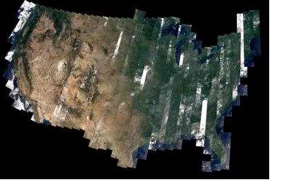
Researchers in the University of Cincinnati Department of Geography are hard at work tracking drought patterns across the United States implementing an Event-based Spatial-Temporal Data Model (ESTDM) tracing the dynamics of agricultural drought in order to detect, track and monitor these conditions.

Data for this study was collected with the help of the European Space Agency’s (ESA) Soil Moisture and Ocean Salinity (SMOS) satellite. This satellite which uses an L-band passive microwave radiometer can analyze spatial and temporal variations in soil moisture and ocean salinity, and can penetrate the earth’s surface to a depth of 5 cm to provide soil variability for each pixel.

Drought is rated among the most costly disasters with wide-ranging impacts on society. The ability to predict the time and severity of droughts can provide valuable information for disaster risk planning, management and response plans.   

Future research will continue with the new NASA Soil Moister Active Passive (SMAP) satellite to be launched near the end of the year.

The details of this research will be presented at the annual meeting of the Association of American Geographers (AAG) in Tampa Florida this week.      
University of Cincinnati
Thu, 24 Apr 2014 - 12:05

Footer menu

  • Contact
  • Terms of Use

User account menu

  • Log in