![]()
United
Nations
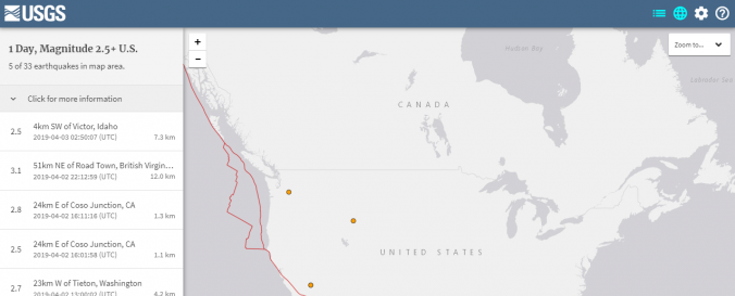
Earthquake Maps (Real Time Earthquake Map - USGS)
| Data provided by: | United States Geological Survey (USGS) |
| Data accessibility: | Exportar datos, Exportar mapa, Visualización de datos (ej. web SIG o monitoreo en tiempo real) |
| Link to the data: | |
| Data type: | Datos sobre amenazas específicas |
| Hazard: | Earthquake |
| Disaster cycle phase: | Gestión des Riesgo por Desastres, Respuesta, Recuperación |
| Space-based Information: | GOES |
| Spatial coverage: | Global |
| Temporal coverage: | Archivado, Casi en tiempo real |
| Content dates: | 1900-present |
| Technical Specifications: | |
| Costs: | Gratis |
| Contact: | Contact Form |
| Tutorials on the use of data: | Using the Latest Earthquakes Map and List, Help for Earthquake Search |
| Restrictions/ Citation of the dataset: |
Provider
![]()