![]()
United
Nations
Storm Detection and Forecast Map (Tropical Cyclones - CIMMS)
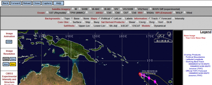
| Data provided by: | Cooperative Institute for Meteorological Satellite Studies / University of Wisconsin-Madison (CIMSS-WISC) |
| Data accessibility: | Exportar datos, Datos estadísticos (ej. gráficos), Visualización de datos (ej. web SIG o monitoreo en tiempo real) |
| Link to the data: | |
| Requirements: | Man computer Interactive Data Access System (McIDAS) |
| Hazard: | Severe Storm |
| Disaster cycle phase: | Gestión des Riesgo por Desastres |
| Space-based Information: | Spaced based infra red sensors |
| Spatial coverage: | Global, Northern America, Asia |
| Spatial resolution: | 50000.00 |
| Temporal coverage: | Archivado, Casi en tiempo real |
| Technical Specifications: | |
| Costs: | Gratis |
| Contact: | CIMSS Tropical Cyclone Team |
| Tutorials on the use of data: | How to work Advanced Dvorak Technique (ADT) , How to Interpreting UW-CIMSS Advanced Microwave Sounding Unit (AMSU) Imagery/Pr…, Atmospheric motion vectors (AMV) , Product Description of Morphed Integrated Microwave Imagery at CIMSS |
| Restrictions/ Citation of the dataset: |
Provider
![]()