![]()
United
Nations
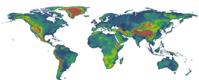
Digital Elevation Model - SRTM 4.1 (CGIAR-CSI)
| Data provided by: | Consultative Group on International Agricultural Research - Consortium for Spatial Information (CGIAR-CSI) |
| Data accessibility: | Exportar datos |
| Link to the data: | |
| Data type: | Elevación |
| Hazard: | Mass Movement, Flood |
| Disaster cycle phase: | Gestión des Riesgo por Desastres |
| Space-based Information: | SRTM |
| Spatial coverage: | Global |
| Spatial resolution: | 90 - 1,000m |
| Temporal coverage: | Archivado |
| Content dates: | 2000 |
| Technical Specifications: | |
| Costs: | Gratis |
| Tutorials on the use of data: | SRTM Data Processing Methodology |
| Restrictions/ Citation of the dataset: |
Cite this data in any published material produced using this data, and if possible link web pages to the CIAT-CSI SRTM website (http://srtm.csi.cgiar.org).
|
Provider
![]()